February 25, 2011
Google Earth Imagery: Christchurch and new Tripoli
New satellite imagery available from our partners at GeoEye.
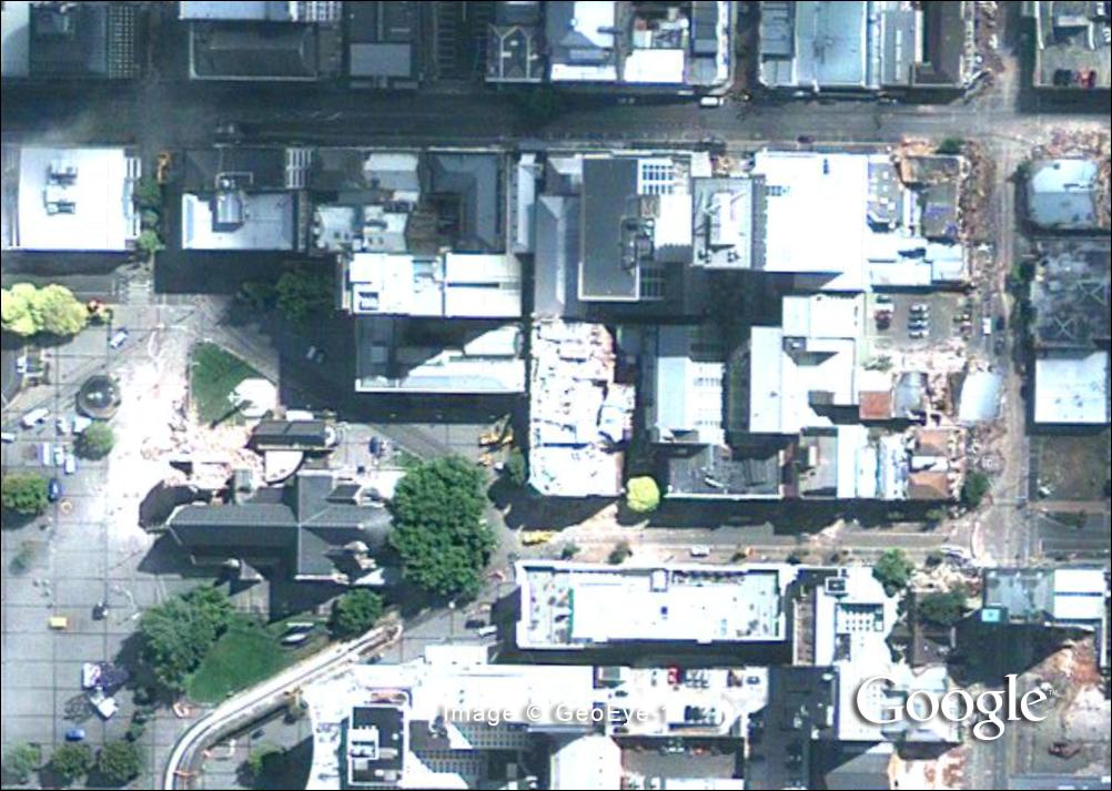
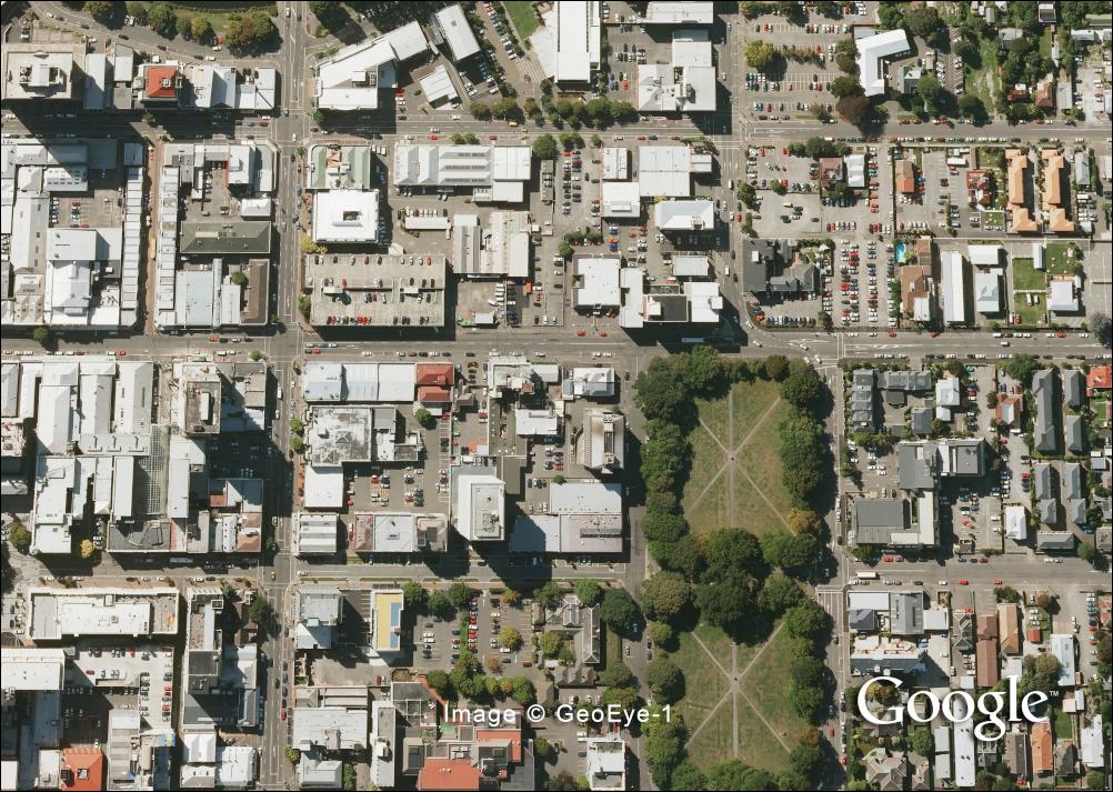
Imagery of Christchurch was taken on Thursday, February 24th from the GeoEye-1 satellite. Some parts are covered in
clouds but substantial portions of the central business district are clearly visible. Remember to turn the layer on and
off to compare it with our previous imagery, which is from March 2009.
Imagery of Tripoli was taken on Thursday, February 24 from the IKONOS satellite and is substantially less cloudy than
the imagery we distributed yesterday.
Click for big version
Church Before
Click for big version
Collapsed Church and Surrounding Buildings
Park and Buildings Before
Park and Collapsed Buildings