Scientists Create 3D Map Of Universe
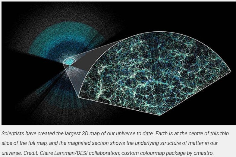
An international team of researchers has created the world's largest and most detailed 3D map of the universe – measuring the expansion of the cosmos over the past 11 billion years.
Dr Cullan Howlett from The University of Queensland helped develop pivotal software used for analysing data collected as part of the Dark Energy Spectroscopic Instrument (DESI) survey, which last year released its first insights into dark energy, the mysterious force behind the universe’s expansion.

Key points:
- Galaxies and massive celestial objects have been mapped with unprecedented detail, creating the largest map of the universe ever constructed.
- UQ researchers developed the key software used for analysing and modelling remnant sound waves from the early universe.
- The information allowed researchers to study how the universe has evolved over time and measure the effect of dark energy.
Using the new data, the DESI collaboration has made the most precise measurements to date of how fast the universe has expanded throughout history.
“The team at UQ was responsible for developing one of the key pieces of software used for analysing the survey data, which helps search for a very specific feature in the map,” Dr Howlett said.
“The software models the size and shape of the Baryon Acoustic Oscillation (BAO) feature, a remnant of sound waves from the early universe.
“The BAO’s size acts as a standard ruler, and by comparing its size at different distances from earth to how big it should have been in the early universe, we can measure the expansion rate of the universe.
“This information allows us to peer 11 billion years into the past and study how the universe has evolved over time and measure the effects of matter and dark energy.”
The 3D map is comprised of the spatial coordinates and distances of millions of galaxies.
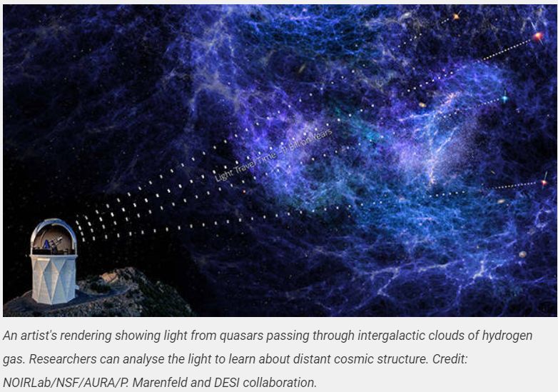
Researchers can measure the longitudinal and latitudinal position of each galaxy, as well as its unique light ‘fingerprint’ – observed by measuring the presence of chemical elements like hydrogen, oxygen, and nitrogen.
“We decoded that fingerprint, identified the individual elements, and compared the measured frequencies to those in a lab on Earth to get the distance from us,” Dr Howlett said.
“Once we had millions of sky positions and distances, we put each galaxy at its location relative to earth and built a literal 3D map to analyse.”

Collaborator, Dr Ryan Turner from Swinburne University of Technology played a critical role developing statistical tools for measuring the motions of galaxies in the local universe.
Dr Turner developed software that can capture the information hidden in galaxy motions, to learn about the laws of gravity and calculate the rate at which the Universe’s largest structures form.
“This is like going from a hand-drawn map of the universe to a satellite image,” Dr Turner said.
“With our much more detailed map, we can picture a larger area and now have significantly more detail in those farther away places and a much more detailed understanding of the structure in our patch of the universe.
“DESI’s new data greatly surpasses all previous surveys of its kind, and with better maps comes better understanding of some of the universe’s most enduring questions.”
Dr Turner said there were also plenty of cosmic surprises to come.
“As the 3D map evolves with more data, we anticipate our understanding of cosmic structures, dark energy, and the fundamental laws governing our universe will continue to refine,” he said.
“But for now, we’ll continue to explore this map in search of more universal dark secrets.”
The DESI data is now available online.
DESI is supported by the DOE Office of Science and by the National Energy Research Scientific Computing Center, a DOE Office of Science user facility. Additional support for DESI is provided by the U.S. National Science Foundation; the Science and Technology Facilities Council of the United Kingdom; the Gordon and Betty Moore Foundation; the Heising-Simons Foundation; the French Alternative Energies and Atomic Energy Commission (CEA); the National Council of Humanities, Sciences, and Technologies of Mexico; the Ministry of Science and Innovation of Spain; and by the DESI member institutions.
The DESI collaboration is honoured to be permitted to conduct scientific research on Iolkam Du’ag (Kitt Peak), a mountain with particular significance to the Tohono O’odham Nation.


 Imported Motor Vehicle Industry Association: EV Battery Fires Expose New Zealand Regulatory Gap
  Electricity Authority: Electricity Authority Welcomes Plan To Empower Consumers And ‘Make NZ More Electric’
 Pamu Farms: New Zealand Farm Dog Genetic Study Shows Top Five Health Risks
 EDANZ: Payments NZ Forcing The World’s Most Aggressive Removal Of EFTPOS Terminals
 Great Journeys New Zealand: Back By Popular Demand, The Southerner Returns
 New Zealand Association of Scientists: Budget 2025 Robs Researchers To Pay For Regulation


