 Scoop has an Ethical Paywall


Unsettled Beginning To The Week
The beginning of the week starts off unsettled with a frontal feature zipping up the country but MetService has settled conditions setting in for many from midweek.
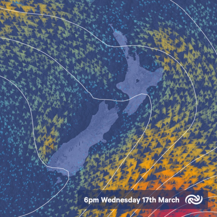
MetService meteorologist Andy Best comments “Forecasters are picking a front, to move northeast over the South Island today and early Tuesday, bringing heavy rain to western parts of the South Island. Heavy falls for Westland Ranges where a Warning is in force. Heavy rain watches are also in place for Fiordland, the headwaters of the Otago and Canterbury lakes and rivers, and Buller as well. We also have a strong wind watch in force for Canterbury High Country for northwesterlies ahead of the front.”
The front also brings some rain to the south and west of the North Island on Tuesday, but the rain weakens to showers in the afternoon, eventually clearing those areas in the evening. Showers also develop over eastern and northern areas in the afternoon and evening, although they should be few and far between north of about Taupo. Winds over the upper North Island on Tuesday are expected to be light and variable in the morning, with coastal sea breezes from about midday. By Tuesday evening, southwesterly winds should cover the entire North Island.
The southerlies die away over the lower South Island Tuesday and Wednesday, as a ridge of high pressure moves in from the west. This leads to the possibility of light frosts in inland basins of Otago and Southland Tuesday and Wednesday nights. As the ridge builds over the North Island on Thursday, it also leads to onshore easterly winds about eastern parts of the island. These winds bring more cloudy skies, and cooler conditions to places such as Gisborne, Hastings and Masterton with maximum temperatures expected around 17 or 18C. These are between 4 and 5 degrees below average for this time of year.
Finally, as the ridge of high pressure becomes firmly established across the country from Friday, we are picking fine weather for most places this weekend, with temperatures close to average for March.
 NZAS: New Zealand Association Of Scientists Awards Celebrate The Achievements Of Scientists And Our Science System
 Stats NZ: Retail Spending Flat In The September 2024 Quarter
 Antarctica New Zealand: International Team Launch Second Attempt To Drill Deep For Antarctic Climate Clues
 Vegetables New Zealand: Asparagus Season In Full Flight: Get It While You Still Can
  Bill Bennett: Download Weekly - How would NZ telecoms cope with another cyclone
 NZ On Air: Firm Audience Favourites Lead NZ On Air Non-Fiction Funding


