 Scoop has an Ethical Paywall


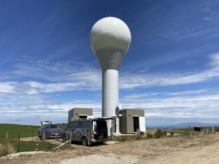
Otago radar in operation
As of today, people in Otago can access real-time radar data through MetService platforms.
Acting MetService Chief Executive Keith Hilligan states, “It’s been a long time coming, but we know this radar will make a difference to Otago communities, and we are delighted it is in operation before Christmas. The radar further strengthens our national radar network, while providing additional resilience to Otago communities especially in severe weather events.”
The radar site, located 25 kilometres northwest of Dunedin and 750 metres above sea level, provides excellent coverage of Dunedin City, the Taieri and Clutha River catchments, and eastern Otago from the Catlins to the Waitaki.
The $3 million radar is the tenth in the national network of weather radar owned and operated by MetService. The radar uses the latest dual polarisation technology which can identify different types of precipitation, be it rain, hail or snow.
MetService is designated as New Zealand’s only severe weather forecasting and warning authority through its contract with the Ministry of Transport, and the national weather radar network plays an essential role in the delivery of public-safety services.
Aside from its forecasting value to MetService meteorologists, real-time radar data is of great importance to hydrologists, emergency management staff and the coastal Otago community, to plan, prepare and make decisions based on the likely impact of weather.
Mayor of Dunedin Aaron Hawkins says, “A local weather radar is something our community desperately needs. More accurate weather forecasting is helpful for anyone who works on the land, and means we’ll be able to plan our responses to extreme weather events more effectively.”
Otago Regional Council’s GM of Operations Gavin Palmer adds, “MetService’s new weather radar joins a range of data inputs for more accurately predicting and understanding weather hazards facing coastal Otago, and particularly South Dunedin. It’s great to have the cutting edge in severe weather forecasting here in Otago, and it will have real benefits for our communities during floods.”
“Building a new radar that
provides accurate coverage in Coastal Otago’s complex
terrain was a challenging project, there’s been many
factors to consider. We reviewed more than 20 locations
before even confirming the radar site. I want to pass on our
thanks to the landowner for their support throughout the
process, both Dunedin City and Otago Regional Councils for
their commitment, and the wide range of contractors we’ve
worked alongside to get this radar in operation. And
finally, our own project team here at MetService who have
worked so hard to get this operating” says Keith
Hilligan.
All New Zealand radar imagery is updated every seven and a half minutes, and is available on metservice.com, MetService apps, and through MetService commercial products.
Ends
• Radar data allows
MetService to provide a severe thunderstorm warning service
within the radar coverage area as part of its severe weather
warnings and watches programme, as it does for the nine
other radar areas in New Zealand. The public can sign up
here.
• MetService operate nine other radar in
Northland, Auckland, Bay of Plenty, Taranaki, Hawkes Bay /
Gisborne, Wellington, West Coast, Canterbury and
Southland.
• Images of the completed Otago Radar, the
build process of the radar, and MetService radar locations
are
attached.
 SolarZero: SolarZero Limited (in Liquidation) - Important Business Update
 Science Media Centre: Cyclone Gabrielle's Impacts On NZ's Ecosystems - Expert Reaction
 RNZ: Parts Of Power System Could Be Out For 36 Hours In Event Of Extreme Solar Storm
 NZAS: New Zealand Association Of Scientists Awards Celebrate The Achievements Of Scientists And Our Science System
 Stats NZ: Retail Spending Flat In The September 2024 Quarter
 Antarctica New Zealand: International Team Launch Second Attempt To Drill Deep For Antarctic Climate Clues


