 Scoop has an Ethical Paywall


Another dry week ahead, with temperatures rising
MetService is forecasting a slow-moving ridge of high pressure will bring dry and settled weather to most of the country this week, with no relief likely for parched areas. A southwesterly flow has kept temperatures on the cool side of the ledger over the weekend, but by mid-week the majority of towns and cities should be experiencing above average temperatures again.
MetService Meteorologist Peter Little commented, “Fiordland and Westland south of the Glaciers are the only places likely to receive more than a few millimetres of rain this week, as a persistent ridge over northern and central New Zealand keeps other weather systems at arm’s length. Temperatures are expected to warm up by the middle of the week, with 30°C forecast for Hamilton, Taumarunui and Masterton on Wednesday, and 32°C predicted for Gisborne and Hastings on Thursday.”
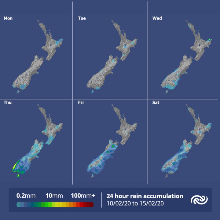
Meanwhile, Tropical Cyclone UESI was named by the Fiji Meteorological Service in the early hours of this morning. The now Category 2 Cyclone is currently located west of Vanuatu, and is forecast to track southwards over the next few days. “Tropical Cyclone UESI should pass close to or over New Caledonia on Wednesday, then move over the northern Tasman Sea by the weekend. There is no threat to New Zealand from the cyclone this week, and MetService’s Tropical Cyclone Specialists will continue to monitor this system as it evolves,” added Little.
 SolarZero: SolarZero Limited (in Liquidation) - Important Business Update
 Science Media Centre: Cyclone Gabrielle's Impacts On NZ's Ecosystems - Expert Reaction
 RNZ: Parts Of Power System Could Be Out For 36 Hours In Event Of Extreme Solar Storm
 NZAS: New Zealand Association Of Scientists Awards Celebrate The Achievements Of Scientists And Our Science System
 Stats NZ: Retail Spending Flat In The September 2024 Quarter
 Antarctica New Zealand: International Team Launch Second Attempt To Drill Deep For Antarctic Climate Clues


