 Scoop has an Ethical Paywall


Expedition reveals the violent birth of Zealandia

Expedition reveals the violent birth of Earth’s hidden continent Zealandia, forged in a ring of fire
IODP, Author provided
Rupert Sutherland, Te Herenga Waka—Victoria University of Wellington and Gerald Dickens, Rice University
Three years ago, the identification of Zealandia as a continent made global headlines.
Now, newly published results from our scientific drilling expedition reveal the largely submerged Zealandia continent, which stretches across five million square kilometres beneath the southwest Pacific Ocean, was shaped by two tectonic events.
First it was ripped away from Australia and Antarctica, and then it was carved by forces that started the Pacific Ring of Fire.
Why Zealandia is so different to other continents
Zealandia has an unusual geography for a continent. More than half the surface area of Earth’s other six continents are composed of low-lying land and shallow seas, and they have relatively narrow mountain ranges and steep continental slopes in the deep ocean.
In contrast, Zealandia is mostly hidden beneath more than one kilometre of water and could be classified as more than 90% continental slope. This makes it a challenge to explore.
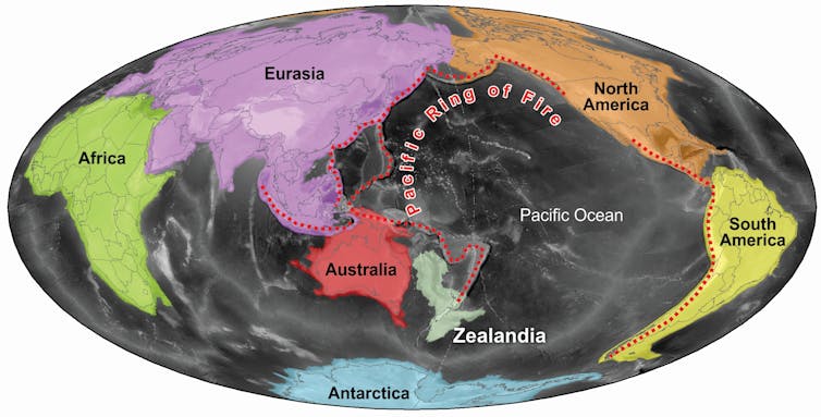
The world’s continents and Zealandia, at the southern end of the Pacific Ring of Fire.
Author provided
The first scientific drilling expedition to sample in the area where we now know Zealandia is took place in 1972 between Australia, New Zealand and New Caledonia. The results suggested tectonic forces stretched and thinned Zealandia’s crust until it was ripped from the ancient supercontinent Gondwana about 85 million years ago, during the time of dinosaurs. This created a deep ocean: the Tasman Sea.
The evidence remains compelling that this is at least part of the answer to how the geography of Zealandia formed. But detailed surveys during the 1990s and 2000s, carried out to establish sovereignty over the Zealandia continental mass by New Zealand, Australia and France, suggested other contributing factors.
Read more:
What
are lost continents, and why are we discovering so
many?
How the Pacific Ring of Fire shaped Zealandia
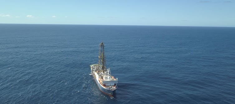
In 2017, we led a nine-week expedition into the southwest Pacific as part of the International Ocean Discovery Program (IODP), with 32 scientists on board the research vessel JOIDES Resolution. Our aim was to unravel why Zealandia is so different from the other continents.
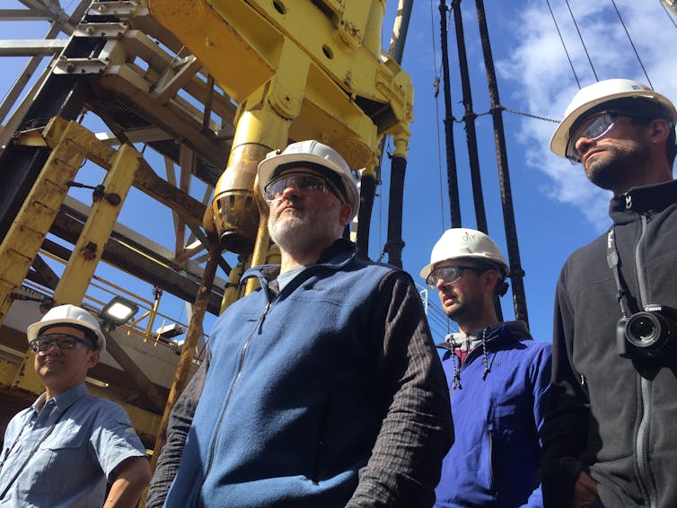
Sanny Saito (Japan), Rupert Sutherland (New Zealand), Thomas Westerhold (Germany), and Edo Dallanave (Italy) on the drill floor of the JOIDES Resolution.
Michelle Drake, Author provided
Our newly published results have been drawn from that expedition 371, where we collected new samples and sought to test our hypothesis that formation of the Pacific Ring of Fire played a key role in shaping Zealandia.
We collected sediment cores from up to 864 metres beneath the seabed at six sites far away from land or shallow water. At the deepest site, the water was five kilometres deep and our drill weighed 300 tonnes. We used fossils from three of the sites to show northern Zealandia became much shallower and likely even had land areas between 50 and 35 million years ago. At about that time, two other sites became submerged into deeper water, and then the whole region subsided an additional kilometre to its present depth.
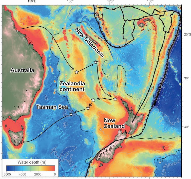
The expedition drilled for samples at six sites, marked on this map with stars.
IODP, Author provided
These dramatic changes in northern Zealandia, an area about the size of India, coincided with buckling of rock layers (known as strata) and the formation of underwater volcanoes throughout the western Pacific.
The Pacific Ring of Fire is a zone of volcanoes and earthquakes running along the west coasts of north and south America, past Alaska and Japan, and then through the western Pacific to New Zealand. The violent geological activity in this zone reflects deeper unrest at the boundaries of tectonic plates, caused by “subduction processes” – where one tectonic plate converges on another and sinks back deep into the earth.
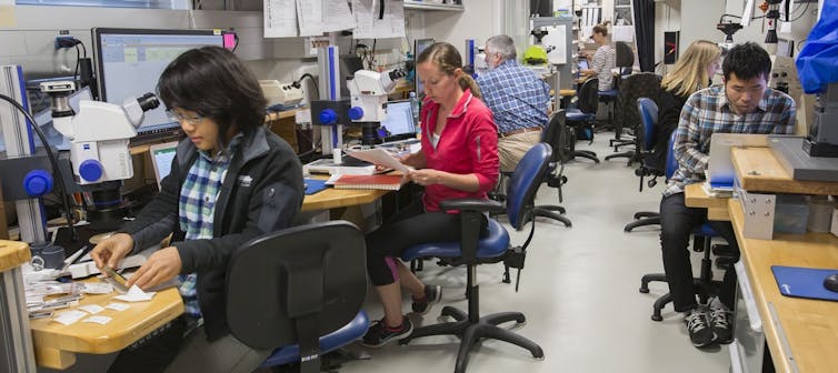
Scientists on the expedition identify fossils in sediment cores.
IODP, Author provided
Read more:
Explorers
probe hidden continent of Zealandia
We know the Pacific Ring of Fire formed about 50 million years ago, but the process remains a mystery. We propose a “subduction rupture event” – a process similar to a massive slow-moving earthquake – spread around the whole of the western Pacific at that time. We suggest this process resurrected ancient subduction faults, which had lain dormant for many millions of years but were primed to start moving again.
This concept of “subduction resurrection” is a new idea and may help explain a range of different geological observations. The subduction rupture event included unique geological phenomena that that have no present-day comparison, and there may have been fewer than 100 such massive events since Earth formed. Our new evidence from Zealandia shows these events can dramatically alter the geography of continents.
What were the consequences of these geographic changes for plants, animals and regional climate? Can we make a computer model of the geological processes that happened at depth? We are still figuring some of this out, but we do know the event changed the direction and speed of movement of most tectonic plates on Earth.
It was an event of truly global significance –
and we now have really good observations and ideas to help
us get to the bottom of what happened and why.![]()
Rupert Sutherland, Professor of tectonics and geophysics, Te Herenga Waka—Victoria University of Wellington and Gerald Dickens, Professor, Rice University
This article is republished from The Conversation under a Creative Commons license. Read the original article.
 GNS Science: Bioshields Could Help Slow Tsunami Flow
 Transport and Infrastructure Committee: Inquiry Into Ports And The Maritime Sector Opened
 Netsafe: Netsafe And Chorus Power Up Online Safety For Older Adults
 RBNZ: 10 Cent Coin With King Charles III Image Now In Production
 NZALPA: Safety Improves From AKL Incident Learnings
 NIWA: Antarctic Footprint Clean-up Challenges - How A Remote Antarctic Base Clean-up Protected One Of Earth’s Clearest Lakes