 Scoop has an Ethical Paywall


MetService have issued their first Severe Red Warning
03/02/20
MetService, is New Zealand’s only authorised provider of Severe Weather Watches and Warnings – the public alerts for severe weather. This is the first Red Warning MetService has issued since introducing this new level of warning reserved for the most extreme weather events where significant impact and disruption is expected.
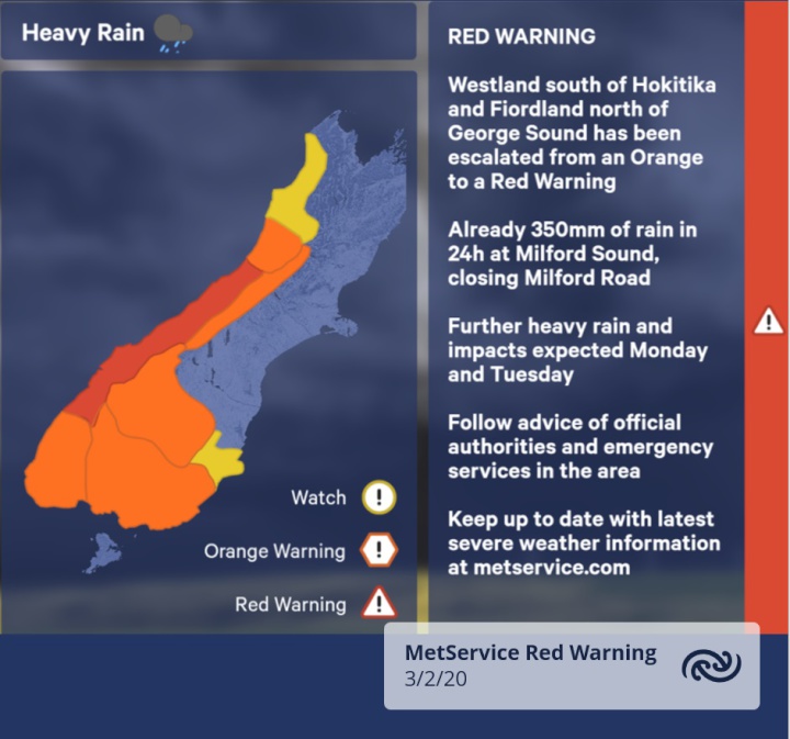
Westland south of Hokitika and Fiordland north of George Sound has been escalated from an Orange to a Red Warning.
MetService meteorologist and Head of Weather Communication, Lisa Murray explains; “This Red Warning is issued after consultation with the West Coast Regional Council and the local Civil Defence after careful consideration of the impacts the area could see in this kind of weather event.”
There has already been significant rainfall at the MetService rain gauge at Milford Sound recording 350mm in 24 hours till 10am this morning (Monday), closing State Highway 94 (the Milford Road).
MetService meteorologists are expecting a further 300mm to 450mm of rain possible today and tomorrow to accumulate on the ranges on top of what has already fallen, with peak intensities of 15 to 25mm/h in general, but up to 40mm/h might be experienced.
“This amount of rain can cause significant impacts to those living or traveling through the area. You can expect dangerous river conditions, significant flooding, and slips. It is likely to disrupt travel, making some roads impassable and possibly isolating communities. Please check the NZTA website before travel,” advises Murray.
A Red Warning signifies that people need to act now as immediate action is required to protect people, animals and property from the impact of the weather. People should keep up to date with the latest weather warnings at MetService.com and be prepared to follow the advice of official authorities and emergency services.
You can watch MetService's official video about the Red Warning here https://www.metservice.com/video-forecasts#warnings
Other parts of the country:
MetService currently has a number of other Watches and Orange Warnings in place over much of the South Island and parts of the lower North Island, for heavy rain and strong winds.
The warnings are associated with number of fronts over the lower South Island becoming more active tonight and during Tuesday. As a front moves up the South Island later on Tuesday, a cool southerly change spreads north in the wake of the front, through Southland, Otago and Canterbury, bringing rain, sometimes heavy and strong southwesterly winds. The front is expected to weaken as it moves over the North Island during Wednesday.
The warm temperatures, thanks to the persistent northwest winds in the north and east of the country, continue today and Tuesday with a southerly change cooling things from late Tuesday. The temperatures in general go back to normal for this time of year for much of the country on Wednesday.
Keep up to date at metservice.com
 Advertising Standards Authority: ASA 2024 Annual Report - Strengthening Consumer Protections With Effective Ad Self-Regulation
 IRANZ: Budget Reaction – Time To Back Science With Long-Term Investment
 Better Taxes for a Better Future: Budget Of Austerity Piles On Least Well-Off, Misreads Public Mood
 Nicola Gaston, The Conversation: NZ Budget 2025 - Science Investment Must Increase As A Proportion Of GDP For NZ To Innovate And Compete
 Maritime Union of New Zealand: Maritime Union Condemns Threatened Job Losses On Aratere Ferry
 Science Media Centre: Proposed Increase To Glyphosate Limits – Expert Reaction