Fine and Frosty
Southwesterly winds have dominated the weather regime
for the last few days but MetService are forecasting a ridge
of high pressure which is set to bring settled weather with
widespread frosts on Tuesday. The next rain band isn’t
expected to reach our shores until Thursday.
The southwest winds are easing throughout most of the country overnight tonight (Monday) to leave a relatively fine day with light breezes Tuesday morning with frosts expected in sheltered areas. Eastern areas will continue to feel the effects of the cool southwest flow for most of Tuesday.
MetService Meteorologist Lewis Ferris says: “On Wednesday, the ridge takes hold and many places will start the day with frosty conditions. However, eastern areas of the central North Island and Northland will see some isolated showers which ease later in the day.”
Thursday will be another frosty start for many. Western areas of the South Island will be first to feel the effects of the oncoming front bringing northernly winds and rain. The rest of the country can expect to be affected through the night and into Friday.
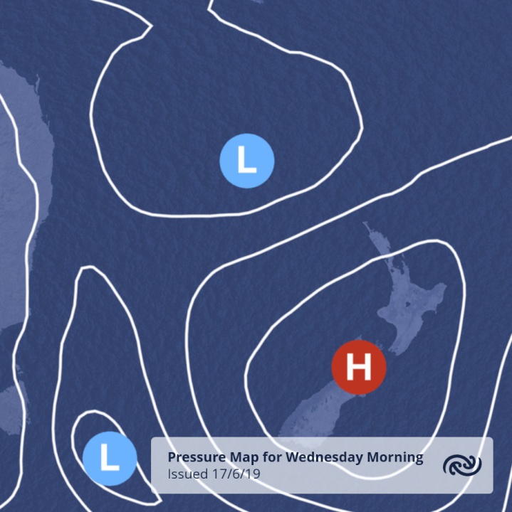
The image below shows a pressure map for 8 a.m. Wednesday, the ridge of high pressure brings clear skies and cold nights.

ends


 Commerce Commission: Systemic Breaches Of Consumer Law Lead To $1.5million Fine For Kiwibank
 SolarZero: SolarZero Limited (in Liquidation) - Important Business Update
 Science Media Centre: Cyclone Gabrielle's Impacts On NZ's Ecosystems - Expert Reaction
 RNZ: Parts Of Power System Could Be Out For 36 Hours In Event Of Extreme Solar Storm
 NZAS: New Zealand Association Of Scientists Awards Celebrate The Achievements Of Scientists And Our Science System
 Stats NZ: Retail Spending Flat In The September 2024 Quarter


