 Scoop has an Ethical Paywall


Southwest Winds Bring Wind Chill and Large Swell
MetService News Release
13 May
2019
Southwest Winds Bring Wind Chill and Large Swell
The weather is slowly improving, after a stormy start to the week. The cold front that brought rain and strong northerly winds on Sunday, is followed by strong southwesterly winds over the country today (Monday).
MetService meteorologist Gerrit Keyser says: "In the southwest wind flow there is another cold front that is making landfall in Fiordland around noon Tuesday, then moves up the South Island bringing strong wind and rain to the West Coast. Although this second front is less intense than the one on Sunday".
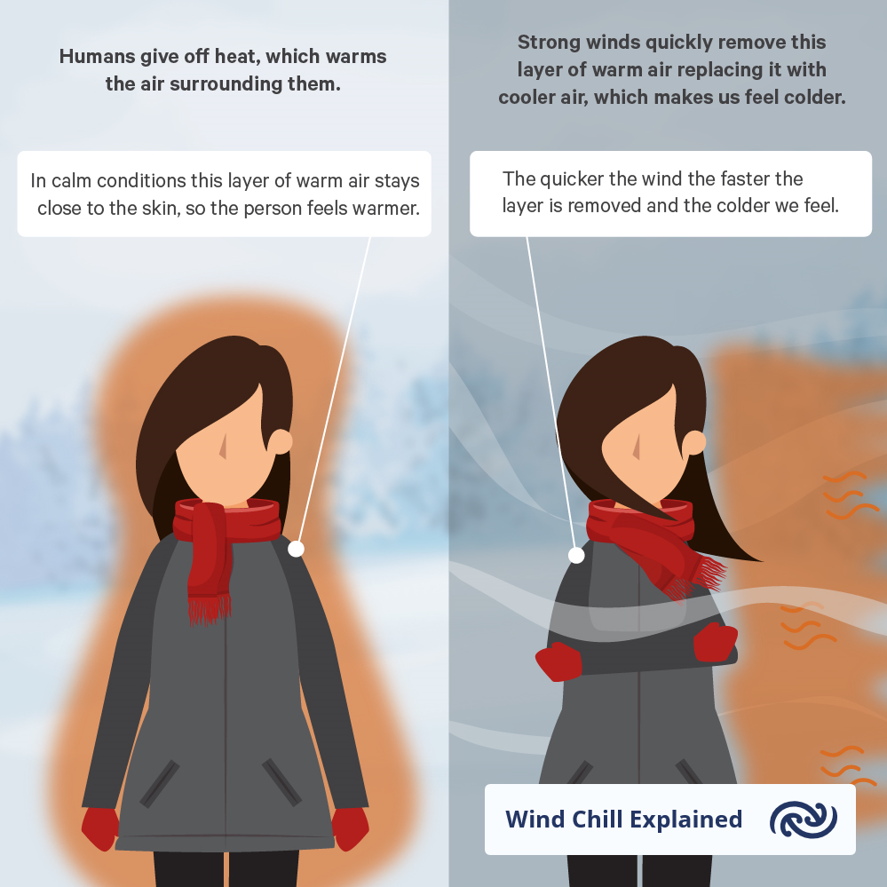
"As we are now well into autumn, we can expect more of these windy, wet and cold systems" continues Keyser, “Areas of Southland and Clutha are going to see significant windchill mid-week, where there could be wind stress for livestock especially in the high country.”
Weaker systems brush the bottom of the country Thursday bringing some showers across the country, but all things considered the week looks mostly dry as the showers are light and short.
Close to average temperatures could feel slightly cooler than what New Zealanders became accustomed to of late, with wind chill a big factor for the deep south. The continued southwest flow brings large swells to the east and west coasts this week.
On the weekend there is another cold, wet snap for New Zealand with a high-pressure building on Sunday.
 Commerce Commission: Systemic Breaches Of Consumer Law Lead To $1.5million Fine For Kiwibank
 SolarZero: SolarZero Limited (in Liquidation) - Important Business Update
 Science Media Centre: Cyclone Gabrielle's Impacts On NZ's Ecosystems - Expert Reaction
 RNZ: Parts Of Power System Could Be Out For 36 Hours In Event Of Extreme Solar Storm
 NZAS: New Zealand Association Of Scientists Awards Celebrate The Achievements Of Scientists And Our Science System
 Stats NZ: Retail Spending Flat In The September 2024 Quarter


