This week set to be the wettest of the year so far
MetService News Release
19
February 2019
This week set to be the
wettest of the year so far.
MetService are forecasting what looks to be the wettest week this year.
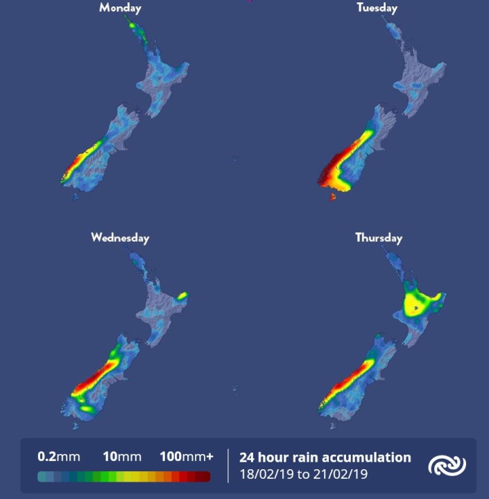
Starting off in the south of the country, a frontal feature along with a warm and moist air mass pushes onto the lower South Island and brings rain with heavy falls reaching warning amounts from Monday through to Wednesday. A Severe Weather Warning is in place for Fiordland and a Severe Weather Watch for Westland south of Fox Glacier and the Otago Headwaters until Wednesday morning.
A ridge of high pressure remains over the North Island with conditions largely fine and dry for Monday and Tuesday While parts of the upper North Island will see some useful showers on Wednesday.
“Warm moist air from the tropics will move over the upper North Island on Wednesday and produce some showers over parched areas of Northland, especially in eastern areas,” states MetService Meteorologist Mark Bowe.
Meanwhile the rain laden front over the South Island weakens with the rain becoming confined to Westland by Wednesday evening.
“On Thursday warm moist air will continue to stream in over the North Island bringing very humid conditions with showers for many areas, which marks the start of wetter weather across much of New Zealand,” adds Bowe.
The wet weather is expected to spread further on Friday as warm tropical air continues to inundate the North Island with showers becoming persistent and heavier in some places. At the other end of the country a frontal feature moves onto the South Island with rain and possible heavy falls forecast.
MetService tropical cyclone experts are keeping a close eye on the developments of Tropical Cyclone Oma. The numerous models available present a number of possible scenarios.
“At this stage there is still some uncertainty across the weather model outputs regarding where Oma will move so there is no definitive answer on its exact path at this point, but what we can be certain about is regardless of where TC Oma tracks, New Zealand we will still see some rain this weekend.”, Bowe explains.
Using the latest weather models, our tropical cyclone forecasters update the MetService TC activity page on our website available at https://www.metservice.com/warnings/tropical-cyclone-activity


 Science Media Centre: Cyclone Gabrielle's Impacts On NZ's Ecosystems - Expert Reaction
 RNZ: Parts Of Power System Could Be Out For 36 Hours In Event Of Extreme Solar Storm
 NZAS: New Zealand Association Of Scientists Awards Celebrate The Achievements Of Scientists And Our Science System
 Stats NZ: Retail Spending Flat In The September 2024 Quarter
 Antarctica New Zealand: International Team Launch Second Attempt To Drill Deep For Antarctic Climate Clues
 Vegetables New Zealand: Asparagus Season In Full Flight: Get It While You Still Can


