Warm windy weather makes way for a cold snap in the south
MetService News Release
22
January 2019
Warm windy weather makes way
for a cold snap in the south
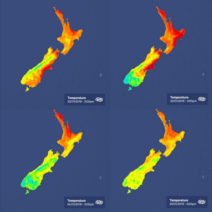
A broad westerly flow makes it windy for exposed parts of the South Island and lower North Island today, while it remains mostly sunny and warm in the north and east.
MetService meteorologist Mark Bowe says, “Eastern areas of the country can enjoy a fine summers day today with the dry northwest winds over the South Island with forecast temperatures expected to reach 29°C for Christchurch, 28°C in Blenheim and Timaru and 26°C in Dunedin.”
There are Severe Weather Watches and Warnings in place, some starting later today (Tuesday), in relation to a heavy rain band and associated strong winds moving onto the lower South Island on Wednesday.
This active front will be preceded by strong northwest winds with possible severe gales forecast for several locations from Southland to Wairarapa, and western areas of the South Island may also see some thunderstorms with the passing of the front.
“While western areas of the South Island will bear the brunt of the heavy rain, most eastern areas of the South Island will see some wet weather on Wednesday,” Bowe confirms.
Those in the lower South Island will see temperatures take a sudden dip as cold air from the far south will brush past the lower parts of the country Wednesday evening, with a dusting of snow in Fiordland above 1400m
It is a different story over the North Island on Wednesday as a warm moist westerly flow blankets the Island, but conditions should be fine and dry in the east for the cricket showdown between New Zealand and India in Napier.
Residents in central parts of the country will see a cold and wet southerly change in the early morning hours of Wednesday, but by the time it reaches Northland Thursday night, the rain band will weaken to a few showers. On Thursday a ridge blankets the country giving a cool southwest flow with just couple of showers to finish off the week.


 Science Media Centre: Cyclone Gabrielle's Impacts On NZ's Ecosystems - Expert Reaction
 RNZ: Parts Of Power System Could Be Out For 36 Hours In Event Of Extreme Solar Storm
 NZAS: New Zealand Association Of Scientists Awards Celebrate The Achievements Of Scientists And Our Science System
 Stats NZ: Retail Spending Flat In The September 2024 Quarter
 Antarctica New Zealand: International Team Launch Second Attempt To Drill Deep For Antarctic Climate Clues
 Vegetables New Zealand: Asparagus Season In Full Flight: Get It While You Still Can


