High and Dry in January
MetService News Release
Friday 4th
January 2019
High and Dry in January
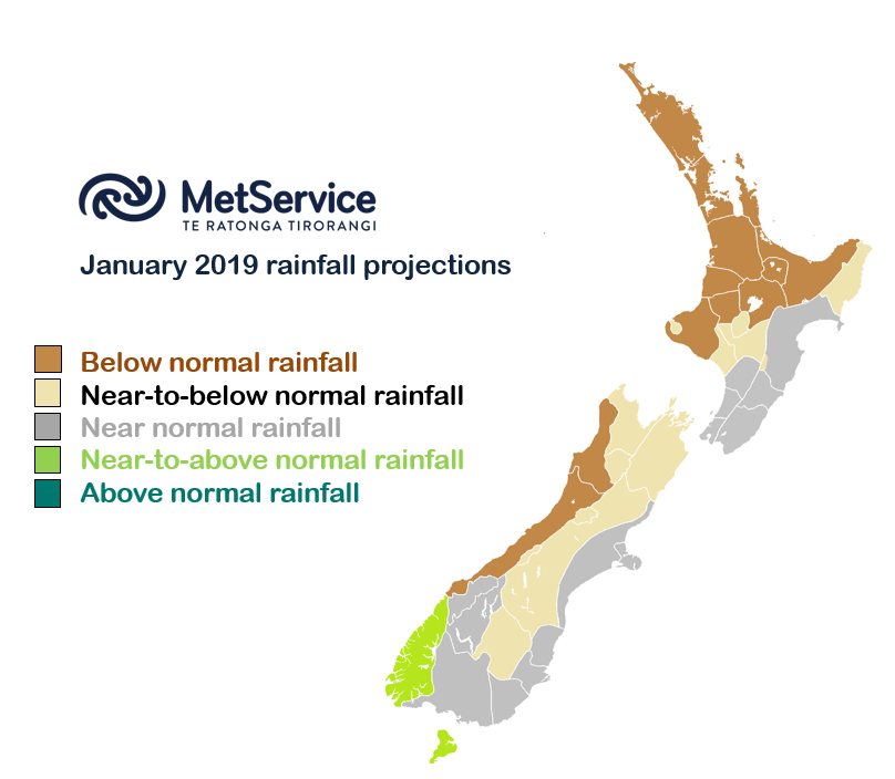
MetService is forecasting a dry start to January thanks to high pressure sitting overhead, at least for the first half of the month anyway.

MetService meteorologist Jake Cope explains how the January weather looks very different to what we saw in December.
“It’s as if the weather knows it’s new year and has made a resolution to behave a little better,” he says.
“Last month was a wet one for many with lots of thunderstorms too. Parts of Bay of Plenty saw three times the December average rainfall. High pressure has put a stop to all that for January,” he confirms.
“Whilst the kind of summer downpours and thunderstorms that we saw in December aren’t unusual for the time of year, they’re much less likely whilst a large area of high pressure is covering Aotearoa. It should keep temperatures above average too.”
Cope says that whilst the outlook is mainly dry, there is still some rain on the way. “In early January we’ll see some rain sneaking around the southern flank of the high pressure, bringing a couple of wet days for the lower South Island through the first weekend of the month. We’ll see another of these from the 9thto the 11th too.
“With the exception of those two events and the odd shower here and there, it does look like a very dry start to the month. Into the second half of January things will start to change as the high pulls away to the north. This should allow for a wetter end to the month, particularly in Fiordland and Southland,” he concludes.
The latest Rural Outlook can be found at www.metservice.com/rural/monthly-outlook. You can keep up to date with the latest forecasts and any watches/warnings at metservice.com or on mobile devices at m.metservice.com. You can also follow our updates on MetService TV, at MetService New Zealand on Facebook, @metservice and @MetServiceWARN on Twitter and at blog.metservice.com.


 Commerce Commission: Systemic Breaches Of Consumer Law Lead To $1.5million Fine For Kiwibank
 SolarZero: SolarZero Limited (in Liquidation) - Important Business Update
 Science Media Centre: Cyclone Gabrielle's Impacts On NZ's Ecosystems - Expert Reaction
 RNZ: Parts Of Power System Could Be Out For 36 Hours In Event Of Extreme Solar Storm
 NZAS: New Zealand Association Of Scientists Awards Celebrate The Achievements Of Scientists And Our Science System
 Stats NZ: Retail Spending Flat In The September 2024 Quarter


