 Scoop has an Ethical Paywall


Clear night for most on Guy Fawkes, but Big Change Coming
05 November 2018
It is an easy start to the week weather-wise with all areas seeing an improvement following the active weather of Saturday. This is good news for the Guy Fawkes celebrations around the country. “As such, we expect a good evening for fireworks displays tonight,” Meteorologist Gerrit Keyser says. “However fireworks can also be dangerous particularly when its windy or dry. We urge anyone setting of fireworks to following the guidance of Fire and Emergency New Zealand.” Lighting fireworks safely tips can be found at https://fireandemergency.nz/recreational-and-cultural/fireworks/.
Tuesday
goes one up on Monday as the good weather continues, but
things change from Wednesday onwards as a front moves onto
the South Island with heavy rain and strong to gale force
winds possible for the latter part of the
week.
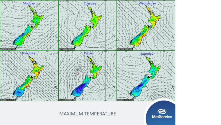
The front moves up the South Island during Wednesday and Thursday and stalls over the northern parts of the Island on Friday due to an approaching low over the Tasman Sea. For the North Island, cloudier and showery weather spreads into western areas from mid-week, but the main rainband only reaches the North Island on the weekend.
“As we’re looking ahead to changeable and potentially severe weather, we urge you to keep up to date with the latest forecast for this coming event.” Gerrit says. “This week’s severe weather outlook includes the possibility of heavy rain and severe gales.” The severe weather outlook can be found on metservice.com at https://www.metservice.com/warnings/severe-weather-outlook.
While the front is set to bring lower temperatures and severe weather to the South Island and lower North Island, farther north settled and warmer weather continues ahead of the front. Temperatures along the east coast in particular are set to reach the high twenties from midweek.
ends
 Waipa Networks: Cambridge Is Open For Business With $45M Energy Boost
 Master Plumbers Gasfitters and Drainlayers NZ: New Consumer NZ Test Reveals Danger Of Unregulated Online Plumbing Products
 Mindful Money: Winners At The Mindful Money Annual Ethical & Impact Investment Awards 2025
 MBIE: Gas Supply Reducing Faster And Sooner Than Previously Forecast
 Natural Hazards Commission: International Markets Show Unprecedented Confidence In NZ’s Natural Hazards Insurance Scheme
  ASB Bank: ASB Business Survey - The Impact Of Trump's Tariffs, According To Kiwi Businesses