 Scoop has an Ethical Paywall


More Heavy Rain for the North Island Early This Week
MetService News Release
12 February
2018
More Heavy Rain for the North Island
Early This Week
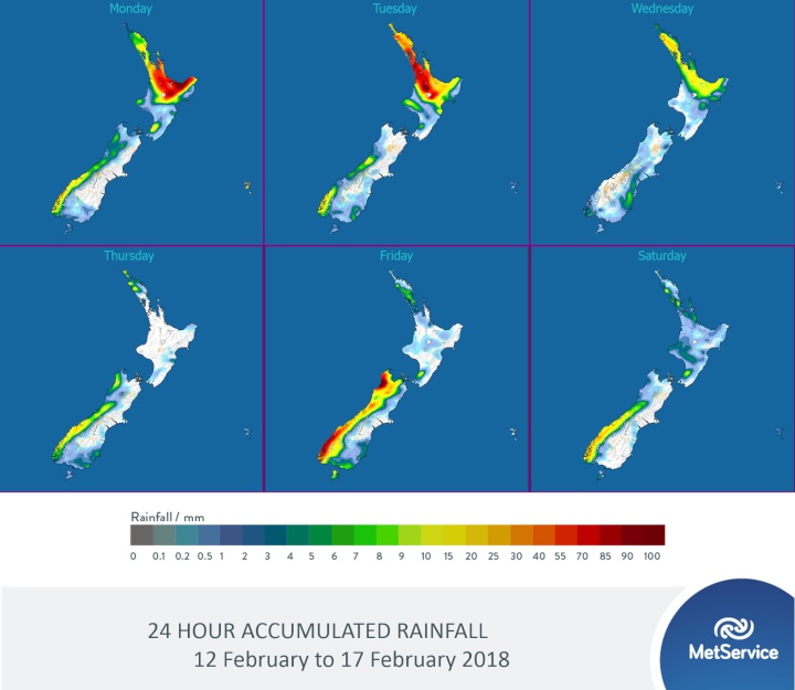
The weekend’s widespread rain delivered a massive 229.5mm accumulation to the western ranges of Nelson, and downpours to western parts of the North Island on Sunday (Levin township recording 24.4mm between 7-8pm Sunday evening).
MetService meteorologist April Clark said, “Rain has become confined to the east of the Bay of Plenty this morning. This narrow band of rain is expected to double back west during today and Tuesday, bringing another period of heavy rain to those in the upper half of the North Island who are just drying out from Sunday’s deluge.”
“Isolated thunderstorms are also possible, especially over western Bay of Plenty, Rotorua, Waikato, Waitomo and northern Taupo on Tuesday,” she continued.
“The subtropical airmass sitting over the North Island is forecast to stay put, so muggy conditions and warmer overnight temperatures reminiscent of last month will continue for the next few days. Overnight temperatures in Auckland are set to dip just below 20C mid-week,” Clark commented.
Isolated showers will linger over the North Island during the later part of the week, but generally much drier and finer conditions will come as a welcome relief.
Looking to the South Island, a series of fronts is forecast to move northward with the west coast bearing the brunt of the rain, though long spells of fine weather are expected between each front. The east coast is looking at a generally fine and warm week, though the far south and Otago may see some cloudy periods and a few showers as each front passes over.
Up in the Tropics, Tropical Cyclone Gita is now a Category 4 system surrounded by hurricane-force winds, and is situated southwest of Niue today (Monday). Gita is forecast to move slowly west across Tonga overnight tonight, then is expected to be south of Fiji on Wednesday morning.
As soon as this Tropical Cyclone passes south of 25S, responsibility for official advisories and bulletins will transfer from Fiji Meteorological Service to MetService’s Tropical Cyclone Warning Centre. There is a possibility that New Zealand could see some impacts from this system; however this is not expected to happen until early next week. Should this be the case, MetService will issue Severe Weather Warning and Watches, press releases and social media posts to ensure the message gets out to the public.
ends
 SolarZero Affected Staff: SolarZero Staff Are Demanding Answers After The Company Went Into Liquidation
 Tātau Tātau O Te Wairoa: Guidance To Save Local Newspapers Amid NZME Closures
 Commerce Commission: Systemic Breaches Of Consumer Law Lead To $1.5million Fine For Kiwibank
 SolarZero: SolarZero Limited (in Liquidation) - Important Business Update
 Science Media Centre: Cyclone Gabrielle's Impacts On NZ's Ecosystems - Expert Reaction
 RNZ: Parts Of Power System Could Be Out For 36 Hours In Event Of Extreme Solar Storm


