Another week of warm and dry
MetService News Release
4 December 2017
Another week of warm and dry
The ridge of high pressure that has dominated New Zealand’s weather of late continues to affect the country this week.
MetService Meteorologist Hannah Moes said, “Warm and mostly dry conditions are forecast to continue for many this week, except for Fiordland and Southern Westland which will enjoy some rain courtesy of a few fronts skirting around the edge of the high.”
“The ridge continues to deliver warm temperatures across New Zealand, with northerlies beginning to spread across southern and central New Zealand boosting temperatures for eastern areas through the Foehn effect - where air dries and warms as it travels across the mountains,” explained Moes.
A maximum temperature of 31C is forecast for some inland parts of the South Island today, and in many places temperatures are forecast to be more than 8C above average for this time of year.
Another mostly fine and warm day is forecast for people celebrating Westland Anniversary today, although this forecast may not be entirely welcome.
The run of dry weather has been exceptional for the west of the South Island, where 24 consecutive dry days have been recorded at Westport so far, making it the longest summer dry spell since records began there in 1963.
At Hokitika, 20 consecutive dry days have been recorded so far, ranking as the fourth longest there for any month, but nowhere near the record of 32 consecutive dry days seen during February and March 2013.
However, the dry spell may break for the west of the South Island late this week, with rain forecast to spread across Westland during Friday and Saturday.

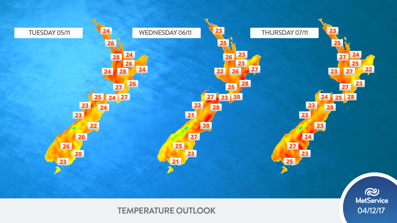
Maximum temperatures for the main centres over the next three days.


 Te Runanga o Ngati Hinemanu: First Marae Based Fresh Water Testing Science Lab Grand Opening 16-17 May 2025
 Raise Communications: NZ Careers Expo Kicks Off National Tour Amid Record Unemployment
 Hugh Grant: How To Build Confidence In The Data You Collect
 Tourism Industry Aotearoa: TRENZ 2026 Set To Rediscover Auckland As It Farewells Rotorua - The Birthplace Of Tourism
 NIWA: Students Representing New Zealand At The ‘Olympics Of Science Fairs’ Forging Pathway For International Recognition
 Coalition to End Big Dairy: Activists Protest NZ National Dairy Industry Awards Again