 Scoop has an Ethical Paywall


Weather on repeat
Monday 30 October
2017
Weather on
repeat
High pressure out to the east of New Zealand is holding its position, meaning that MetService weather maps will not be changing much for the rest of the week, including for Halloween festivitieson Tuesday. The high is directing a northeasterly flow over New Zealand, which will mean that those in the northeast of the country will get some cloudy periods, but those in the lower North Island and the South Island will be mostly fine, apart from a few showers inland in the afternoons.
Warm temperatures in the low to mid-twenties are also expected in the lower North Island and South Island until Thursday, with parts of Southland and inland areas of Otago and Canterbury getting five days with high temperatures of five degrees above average – the criteria for a heat wave.
The warm, fine days also mean that sea breezes are likely to form, which can cause isolated showers to pop up in the afternoons for inland areas. “This is something we commonly see in the warmer months,” explained MetService Meteorologist Claire Flynn. “The showers will generally be quite isolated, meaning many people won’t see one. However, there is a risk that some of those showers could turn into thunderstorms for the likes of inland Wairarapa on Monday and Tuesday, as well as Nelson Lakes and the Kaikoura Ranges.”
The blocking high is good news for those participating in the Tour of Southland cycle race. “While the cycle race has a reputation for coinciding with bad weather, this year Southland will stay mostly dry for much of the week-long event,” said Flynn.
The blocking high will not stay around forever though – with the next weather feature expected to approach the country towards the weekend. A front approaching from the Tasman is forecast to spread rain across much of the country at the end of the week, putting an end to the dry weather and warm temperatures.
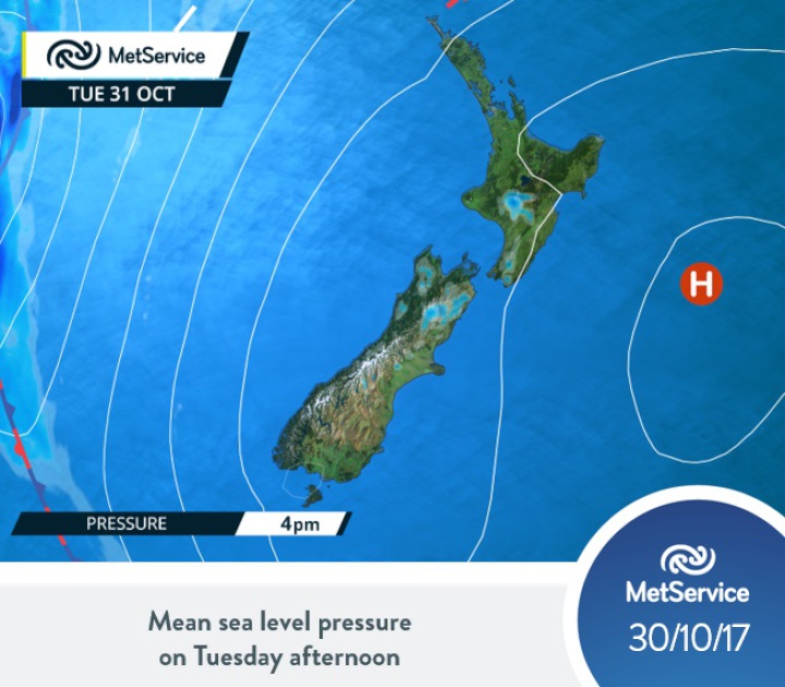
MetService weather charts will not being changing much for most of this week - with a blocking high bringing a northeasterly flow to the country. However, a front lingering in the Tasman brings rain at the end of the week.
Official Severe Weather Watches and Warnings are reviewed and re-issued by MetService at least every twelve hours, and more often if necessary. To get the most up to date information on severe weather around the country, or any other forecasts, see metservice.com or on mobile devices at m.metservice.com. You can also follow our updates on MetService TV, at MetService New Zealand on Facebook, @metservice and @MetServiceWARN on Twitter and at blog.metservice.com
ends
 ERANZ: Electricity Saving Coaching Service To Launch In Wairoa
 SolarZero Affected Staff: SolarZero Staff Are Demanding Answers After The Company Went Into Liquidation
 Tātau Tātau O Te Wairoa: Guidance To Save Local Newspapers Amid NZME Closures
 Commerce Commission: Systemic Breaches Of Consumer Law Lead To $1.5million Fine For Kiwibank
 SolarZero: SolarZero Limited (in Liquidation) - Important Business Update
 Science Media Centre: Cyclone Gabrielle's Impacts On NZ's Ecosystems - Expert Reaction


