 Scoop has an Ethical Paywall


‘Changeable’ is the word
‘Changeable’ is the word
We are still officially in winter, but the current bout of weather is looking decidedly spring-like.
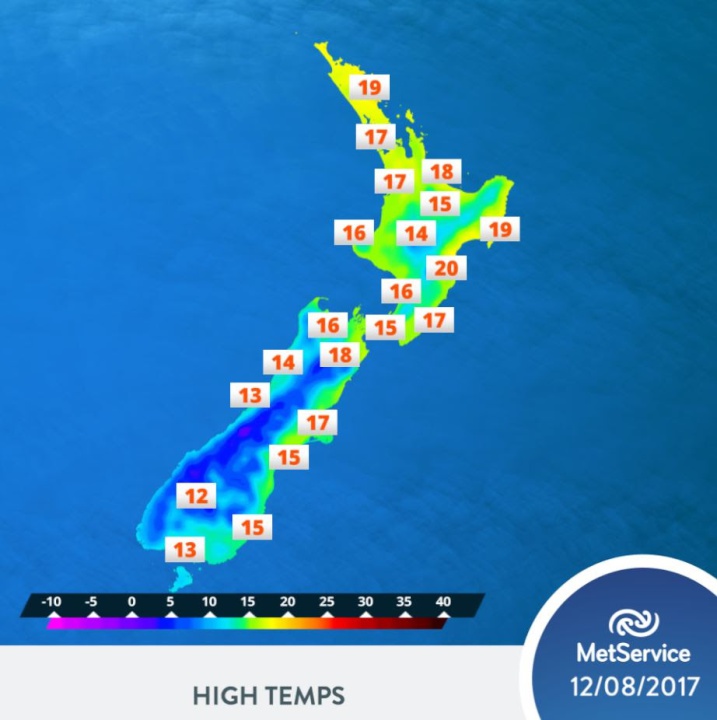
“After yesterday’s front and heavy rain, an unsettled westerly flow has moved in for the weekend; as a result, western areas are still looking wet at times while in the east it will be drier and warmer,” said MetService forecaster Cam Coutts.
There is a wet cold front caught up in these westerlies which moves over the South Island early on Saturday, and then onto the North Island on Sunday.
“The northwest winds ahead of this front help push temperatures into the high teens and early twenties for eastern centres, mainly on Saturday. Northland, Gisborne and Hawke’s Bay are looking like the warmest spots,” said Coutts.
Western areas of the country remain showery. The west of the South Island is also expected to see some thunderstorm activity as the cold front brings a period of persistent rain.
“Luckily this front is a fast mover, so rainfall amounts are not expected to get into Severe Weather Warning or Watch territory,” said Coutts, “but it will bring further accumulations to already damp areas,” he added.
As we head into the next working week, a cooler southwest flow brings snow down to about 700 metres in the south of the South Island. So while there are some signs of spring, there’s a long way to go until summer!
ends
 ERANZ: Electricity Saving Coaching Service To Launch In Wairoa
 SolarZero Affected Staff: SolarZero Staff Are Demanding Answers After The Company Went Into Liquidation
 Tātau Tātau O Te Wairoa: Guidance To Save Local Newspapers Amid NZME Closures
 Commerce Commission: Systemic Breaches Of Consumer Law Lead To $1.5million Fine For Kiwibank
 SolarZero: SolarZero Limited (in Liquidation) - Important Business Update
 Science Media Centre: Cyclone Gabrielle's Impacts On NZ's Ecosystems - Expert Reaction


