 Scoop has an Ethical Paywall


MetOcean Solutions maps potential fate of spills
MetOcean Solutions maps potential fate of spills
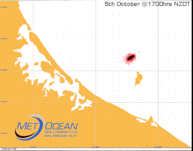
Instant trajectory forecast from MetOcean Solutions supports effective pollution monitoring and response.
As experienced by the Bay of Plenty region with the Rena catastrophe, spills into coastal waters can cause substantial disruption to a region’s local communities, environment and fisheries. Pipeline ruptures, drill rig well leak, exposed well site and vessel collision are all potential environmental disasters. In event of an incident, response teams need to find out as quickly as possible the path of the spill.
MetOcean Solutions instant trajectory forecast supports effective pollution monitoring and response and has been used in pollution spills around New Zealand,
most recently with the Rena grounding. MetOcean Solutions mapped where the expected fallout from the oil and cargo would beach, which supported Rena’s clean up and salvage operation.
Dr David Johnson, Technical Director of MetOcean Solutions, says rather than waiting on weather information to come through, and then running an oil spill trajectory model, responders now have trajectory results available to them in real-time.
“Timing is of the essence for major decisions to be made in the initial stages of an oil spill event,” says Dr Johnson.
To meet this need, MetOcean Solutions has developed a real-time spill trajectory system to instantly forecast where an oil spill or coastal pollution will travel.
Delivered via a web-based forecast platform, the system displays target areas of likely impact. Using historical and short range weather forecast, potential pollution is virtually simulated from both predetermined locations and entered coordinates.
“As soon as a spill occurs, responders can monitor immediately how the oil spill is likely to behave over the next five days. This gives a good indication of what resources may be required and where they need to be deployed,” says Dr Johnson.
In a major incident, the initial simulation result would be backed up with a ‘hands on’ trajectory simulation, which can refine the release timing and magnitude.
Having instant access to this information allows response coordinators to effectively organise the most appropriate resources and actions, which includes being able to provide reliable advice to the offshore personnel as well as local authorities.
These simulations by MetOcean Solution have provided invaluable intelligence to inform response strategies and operational requirements in emergency situations.
This service was put to good use by Maritime New Zealand in the Rena incident.
ends
 Antarctic Heritage Trust: NZ-made ‘Cutting-Edge’ VR Experience Tours The UK
 Brian Gaynor Business Journalism Initiative: Brian Gaynor Initiative Business Journalism Funding Award Moves To Rolling Applications
  Inland Revenue: Fifth Anniversary Of The SBC Loans - Time To Repay
 Te Runanga o Ngati Hinemanu: First Marae Based Fresh Water Testing Science Lab Grand Opening 16-17 May 2025
 Raise Communications: NZ Careers Expo Kicks Off National Tour Amid Record Unemployment
 Hugh Grant: How To Build Confidence In The Data You Collect