 Scoop has an Ethical Paywall


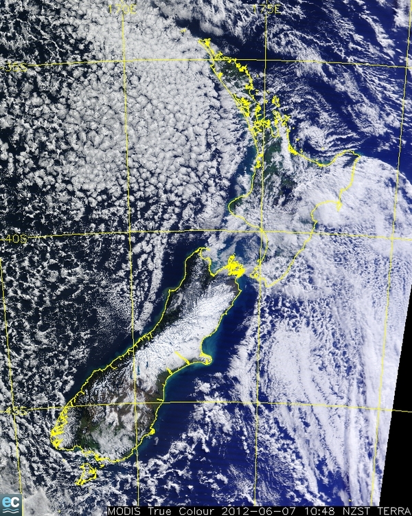
Satellite image of the South Island snow storm
Click for big version.
Satellite image of the South Island snow storm available to download
You may be interested in the following link – http://www.niwa.co.nz/ei/nz-from-space
which shows a satellite image of the snow covering the South Island at the moment.
This latest image over New Zealand was created using data from one of the MODIS sensors flying aboard NASA's EOS satellites: AQUA (EOS-PM1), or TERRA (EOS-AM1). The data were received at NIWA's satellite receiving station at Lauder (Central Otago).
Please credit NIWA.
ENDS
Advertisement - scroll to continue reading
 NZ Certified Builders: BCITO And NZCB Announce Apprentice Challenge 2025
 NIWA: Seasonal Climate Outlook February To April 2025
 Bill Bennett: Are New Zealand's Submarine Links Safe?
 Bill Bennett: DeepSeek Shock Could Spur AI Space Race
 Auckland Property Investors Association: APIA Cautions - New Rental Rules Not A Landlord's Free Pass
 Federated Farmers: Farmers Welcome Kāinga Ora Back-track On Wool Carpets


