Supercomputer Weather: Cyclone Wati Heads For NZ
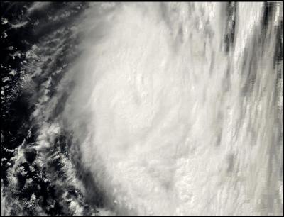
Click for big version
NASA MODIS Satellite Image of Cyclone Wati off the Queensland coast
Supercomputer Weather: Cyclone Wati Heads For NZ
Report compiled by Alastair Thompson
USEFUL LINKS:
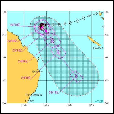
According to the latest forecast from the US Navy and Airforce Joint Typhoon Warning Center Cyclone Wati - which had been following in the footsteps of Cyclone Larry towards the Queensland coast - is about to make a 300 degree turn to the left and head for New Zealand's northern tip.
While it is unlikely to pack cyclone force winds by the time it reaches New Zealand it would most probably bring sustained damaging gale force winds and torrential rain.

Click for big version
Recent Satellite Image of Cyclone Wati off the Queensland Coast
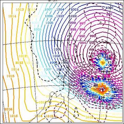
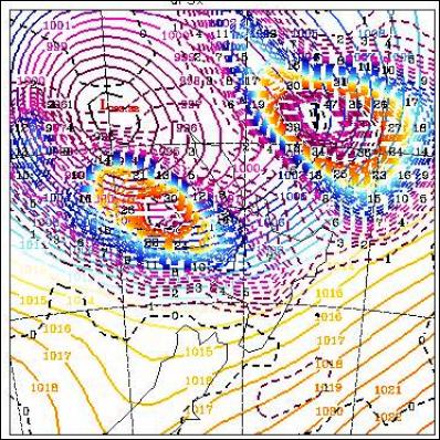
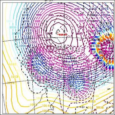
A forecast from the NOAA Global weather computer model ( see below) shows the cyclone grazing the northern tip of Northland early this coming Monday. The tightly bunched isobars indicate gale force winds from Northland to the Waikato initially spreading as far South as Wellington during the day on Monday.
While at this range cyclone behaviour remains highly unpredictable the liklihood of New Zealand being adversely affected by Cyclone Wati appears to be fairly high.
NOAA SUPERCOMPUTER FORECAST SHOWING THE REMNANTS OF CYCLONE WATI HITTING NZ ON SUNDAY NIGHT/MONDAY MORNING
The first forecast in the series below is "+ 96 Hours 18hrs 26 March UTC " which corresponds to 6am Monday March 27 NZT. Each image shows 1milibar pressure gradients and forecast rain over a six hour period in coloured lines.
6am Monday March 27 NZT
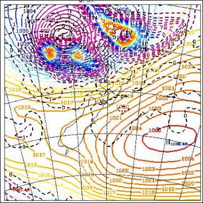
Midday 12pm Monday March 27 NZT
6pm Monday March 27 NZT
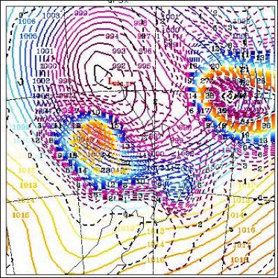
Midnight 12am Tuesday March 28 NZT
6am Tuesday March 28 NZT
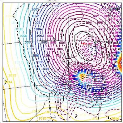
Midday 12pm Tuesday March 28 NZT
****** ENDS ******


 Binoy Kampmark: Closed For Business - The Oddities Of Trump’s Tariffs
 Martin LeFevre - Meditations: Teach Children The Distinction Between The World And Nature
 Ramzy Baroud: Civil War On The Horizon? The Ashkenazi-Sephardic Conflict And Israel’s Future
 Gordon Campbell: On The Government’s Latest Ferries Scam
 Peter Dunne: Dunne's Weekly - While We're Breaking Up Monoliths, What About MBIE?
 Adrian Maidment: Supermarket Signs