Supercomputer Weather: Countdown To Emily's Landfall
Report Compiled By Alastair Thompson
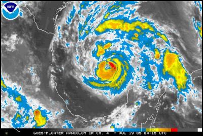
Click for
NOAA animation of Emily approaching Gulf Coast – NOAA
Satellite Services
Division
IMPORTANT NOTE: Official forecasts are provided by the experts at the National Hurricane Warning Center and their advice should be consulted before taking any decisions in relation to the likely path of the hurricane.
Useful Links:
National Hurricane
Warning Center
Weather Underground – Tropical
Google Map of the Texas Coast
Google News – "Hurricane Emily"
Earlier Scoop Report On Hurricane
Emily
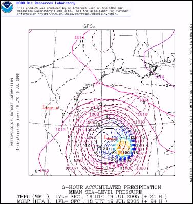
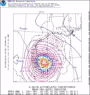
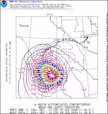
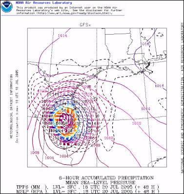
Hurricane Emily is 36 hours away from landfall on the Gulf Coast, most probably close to the Mexico/Texas border ( See supercomputer forecast of landfall below).
The following image shows the most recent National Hurricane Warning Center forecast path.
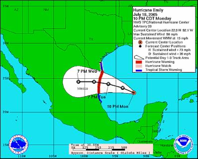
Click for latest track forecast - NHWC
At present the National Hurricane Warning Center is predicting considerable strengthening in the hurricane before landfall, possibly to major hurricane status developing similar winds to those of Hurricane Dennis which struck the Alabama Gulf Coast on July 10th.
DEEP CONVECTION HAS BEEN TRYING TO WRAP AROUND EMILY'S LARGE RAGGED EYE...AND...ALTHOUGH CLOUD TOPS HAVE WARMED SOMEWHAT OVER THE PAST FEW HOURS...THE SYSTEM APPEARS TO BE SLOWLY BECOMING BETTER ORGANIZED. EVEN THOUGH THE CENTRAL PRESSURE HAS NOT YET FALLEN...AIR FORCE HURRICANE HUNTERS FOUND PEAK 700 MB FLIGHT LEVEL WINDS OF 90 KT IN THE NORTHEAST EYE WALL. THIS CORRESPONDS TO A SURFACE WIND OF 80 KT...WHICH IS THE CURRENT INTENSITY ESTIMATE. UPPER-LEVEL OUTFLOW HAS BECOME RATHER SYMMETRIC AS EMILY SHEDS THE INFLUENCE OF A WEAKENING UPPER-LEVEL LOW TO ITS SOUTHWEST. THE OFFICIAL FORECAST SHOWS ADDITIONAL STRENGTHENING...SIMILAR TO THE LATEST GFDL MODEL RUN. EMILY COULD BE APPROACHING MAJOR HURRICANE STATUS PRIOR TO LANDFALL. AFTER LANDFALL...THE CYCLONE WILL WEAKEN RAPIDLY OVER THE MOUNTAINOUS TERRAIN OF MEXICO.
- Source National Hurricane Warning Center
Hurricane Emily was considerably weakened - from Category 4 status down to Category 2 - when she passed over Mexico's Yucatan peninsula over the past 30 hours. The Hurricane made a direct hit on the resort island of Cozumel however initial reports appear to indicate that there were few if any casualties. Before Emily first made landfall it is thought she may have rarely achieved Category 5 intensity making her the earliest most intense Hurricane on record.
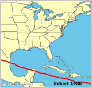
Hurricane Gilbert, the most intense Carribean Hurricane on record followed a very similar path to that of Emily in 1988 and killed several hundred people when it hit the northern Mexican mountains causing massive landslides.
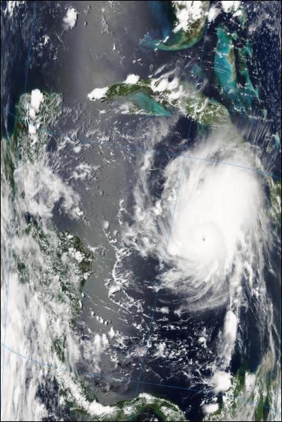
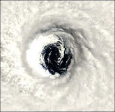
SATELLITE IMAGES OF EMILY
Emily In The Carribean
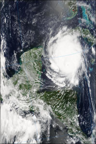
Click for big version
The Eye Of Emily
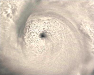
Click for big version
HURRICANE EMILY LANDFALL FORECAST FROM NOAA GFS COMPUTER MODEL
IMPORTANT NOTE: Official forecasts are provided by the experts at the National Hurricane Warning Center and their advice should be consulted before taking any decisions in relation to the likely path of the hurricane.

ENDS



 Keith Rankin: Who, Neither Politician Nor Monarch, Executed 100,000 Civilians In A Single Night?
 Eugene Doyle: Writing In The Time Of Genocide
 Gordon Campbell: On Wealth Taxes And Capital Flight
 Ian Powell: Why New Zealand Should Recognise Palestine
 Binoy Kampmark: Squabbling Siblings - India, Pakistan And Operation Sindoor
 Gordon Campbell: On Budget 2025