Supercomputer Weather: Hurricane Dennis Monstering Gulf Coast
Compiled by Alastair Thompson
Useful Links:
National Hurricane Warning Center
Google News Links: "Hurricane
Dennis"
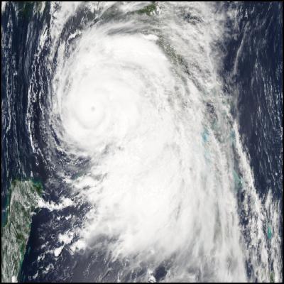
Hurricane Dennis Approaching The Gulf Coast - Image NASA Modis
Click for big version
Hurricane Dennis, a category four monster hurricane packing 230kmh winds, which may yet strengthen to a maximum category 5, is about to strike the Gulf Coast of the mainland United States, most probably close to the Alabama, Florida & Mississippi borders.
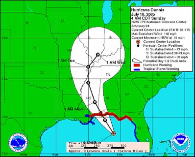
National Hurricane Warning Center forecast track
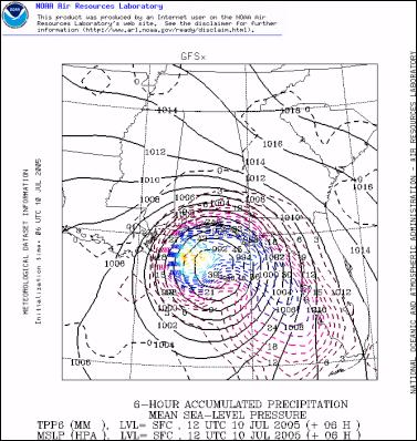
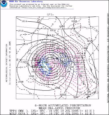
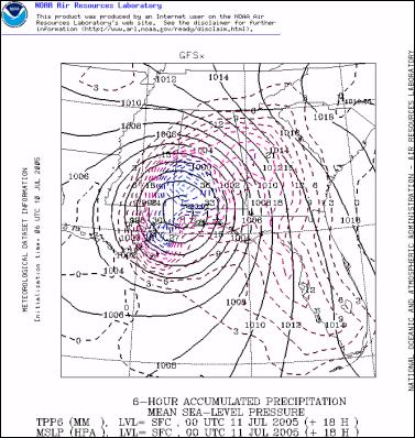
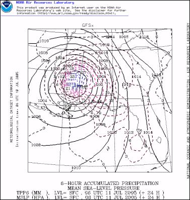
CLICK HERE to view a recent NOAA supercomputer model forecast of the landfall of Hurricane Dennis.
Dennis has already killed several people in Haiti and Cuba and over 1 million people in Florida, Alabama and Mississippi have been asked to evacuate out of Dennis's expected path. Tropical storm force winds have already started to batter the Gulf Coast and over the coming 24 hours some parts of the coast are expected to receive up to 300mm (12 inches) of rain. Hurricane force winds extend up to 40 miles from the center though the highest winds are focused around the eye. Near its center the hurricane is likely to bring ashore a 15foot storm surge. Click Here for the National Hurricane Warning Center's advisory message
Dennis formed in the Carribean sea north of Venezeula around July 4th. During his path north Cuba in particular was very hard hit by the hurricane. It ran up the Island's south coast before crossing close to the capital Havana and as you can see in the following image nearly the entire island experienced at least tropical storm force winds.
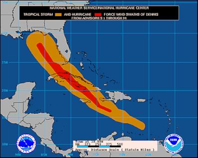
National Hurricane Warning Center wind swathe image for Hurricane Dennis – brown denotes tropical storm force winds and red hurricane force winds
National Hurricane Center forecasters had been uncertain whether the Hurricane would regain its strength after crossing Cuba, but in recent hours there is now no doubt that it has. In the most recent National Hurricane Center discussion alert the forecaster states:
"AFTER DEEPENING AT A RATE THAT BORDERED ON INSANE DURING THE AFTERNOON...DENNIS HAS CONTINUED TO STRENGTHEN AT A MORE NORMAL RATE THIS EVENING.…
THE COMBINATION OF TIGHT INNER CORE...GOOD TO EXCELLENT OUTFLOW OVER THE NORTHEASTERN SEMICIRCLE...WARM SEA SURFACE TEMPERATURES...AND COLD CONVECTIVE TOPS SUGGESTS THAT DENNIS HAS NOT YET FINISHED STRENGTHENING."
The hurricane is now packing maximum sustained winds of 145 MPH just 10 MPH short of Category 5 levels. Meanwhile at the time of posting this story the eye has another 10-12 hours over warm water.
Hurricane Dennis is the fourth named storm of 2005. Already this year the Gulf Coast has been battered by tropical storms Arlene and Cindy. 2005 is the first year since records began in 1851 that there has been four named storms by this stage in July.
Hurricane Dennis is also the first category 4t storm to strike the mainland United States this early in the season since 1957.
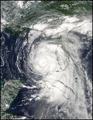
Hurricane Dennis approaching the Gulf Coast - Image NASA Modis
Click for big version
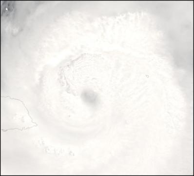
The eye of Dennis
north west of Jamaica in the Carribean - Image NASA
Modis
Click for big version
Click for big
version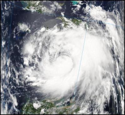
Hurricane Dennis
shortly after he formed north of Venezeula - Image NASA
Modis
NOAA GFS MODEL FORECAST IMAGES OF HURRICANE DENNIS'
LANDFALL
Click for big version


 Ian Powell: Gisborne Hospital Senior Doctors Strike Highlights Important Health System Issues
 Keith Rankin: Who, Neither Politician Nor Monarch, Executed 100,000 Civilians In A Single Night?
 Eugene Doyle: Writing In The Time Of Genocide
 Gordon Campbell: On Wealth Taxes And Capital Flight
 Ian Powell: Why New Zealand Should Recognise Palestine
 Binoy Kampmark: Squabbling Siblings - India, Pakistan And Operation Sindoor