Following close in the wake of hurricanes Charley, Frances and Ivan, three new hurricanes - Jeanne, Karl and Lisa - are now meandering around the Atlantic Ocean and bringing a sense of unease to those living in coastal areas of the United States.
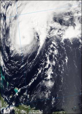
Of the three Jeanne is clearly the most dangerous at present having already killed an estimated 600 people in Haiti. The tropical storm that struck Haiti has since moved north, strengthened, and travelled in a tight loop and now looks to be headed once again back towards the United States coast.
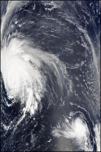
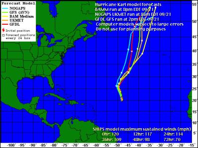
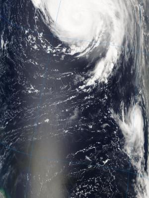
Further out in the Atlantic the biggest of the three Hurricanes Karl is arguably the least threatening as its forecast path keeps it near the middle of the Atlantic Ocean.
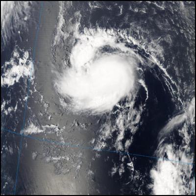
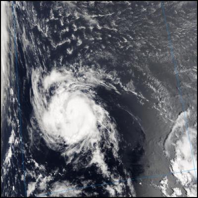
The most recently named Atlantic storm, Lisa, can be considered Karl and Ivan's little sister as she formed in the same area of the Atlantic that spawned both Karl and Ivan. And Lisa, like Ivan appears to be headed in a roughly due westerly direction. Depending on whether she maintains strength and/or course she could in time come to threaten the Carribean and/or South and East coasts of the US mainland.
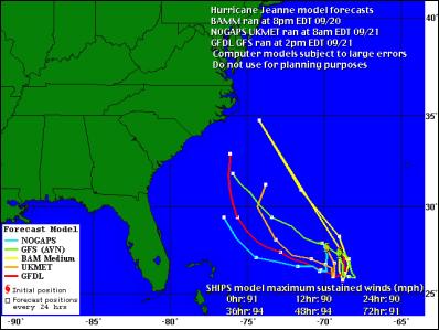
While reading the forecasts below it is worth recalling that the National Hurricane Center has a 400+ nautical mile average error in the location of hurricanes after five days, meaning it very hard to predict the paths that these storms over a period greater than about 24 hours. All that can be said at present about these three storms is that 2004 remains a very active Atlantic hurricane season.
CONTENTS:
Hurricane
Jeanne – Satellite Images
Hurricane Jeanne - FORECASTS
Hurricanes Karl & Lisa – Satellite Images
Hurricane Karl - FORECASTS
Hurricane Lisa – Satellite Images
Hurricane Lisa - FORECASTS
Hurricane Jeanne – Satellite Images
Click for big version
Hurricane Jeanne - FORECASTS
Click for big version
Forecast Map From National
Hurricane Center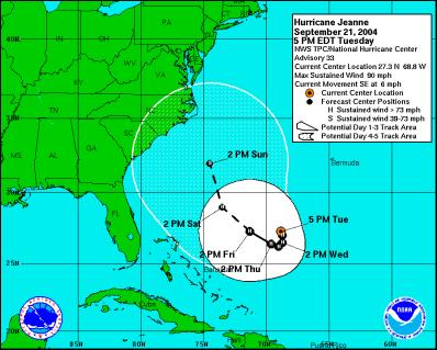
Click for big
version
Hurricanes Karl & Lisa– Satellite Images
Click for big version
Hurricane Karl - FORECASTS
Supercomputer Models From WUnderground.Com
Click for big version
Forecast Map From National
Hurricane Center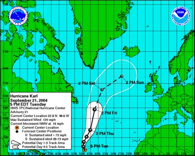
Click for big
version
Hurricane Lisa– Satellite Images
Hurricane Lisa - FORECASTS
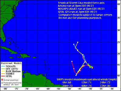
Click for big version
Forecast Map From National
Hurricane Center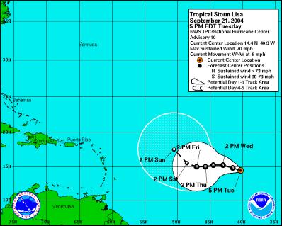
Click for big
version
ENDS


 Keith Rankin: Zero-Sum Fiscal Narratives
 Eugene Doyle: Chinese Jet Shoots Down France’s Best Fighter; NZ And Australia Should Pay Attention
 Ian Powell: “I Can Confirm They Are Hypotheticals Drawn Largely From Anecdotes And Issues The Minister Has Heard About.”
 Gordon Campbell: On NZ’s Silence Over Gaza, And Creeping Health Privatisation
 Richard S. Ehrlich: Pakistan & China Down 6 Indian Warplanes
 Keith Rankin: War In Sudan