 Scoop has an Ethical Paywall


Scoop Images: White America
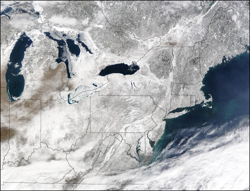
Images from Nasa's Terra MODIS Satellite of the North Eastern United States and South Eastern areas of Canada showing a blanket of snow stretching as far as the satellite can see, from the mid-west and the great lakes to the Atlantic coast. This image was taken on February 20, following one of the largest snow storms in recent memory.
Click For Big Version

Closeup Of
Washington, New Jersey, New York and Long Island
Click
for Big
Version
Advertisement - scroll to continue reading
 Keith Rankin: Zero-Sum Fiscal Narratives
 Eugene Doyle: Chinese Jet Shoots Down France’s Best Fighter; NZ And Australia Should Pay Attention
 Ian Powell: “I Can Confirm They Are Hypotheticals Drawn Largely From Anecdotes And Issues The Minister Has Heard About.”
 Gordon Campbell: On NZ’s Silence Over Gaza, And Creeping Health Privatisation
 Richard S. Ehrlich: Pakistan & China Down 6 Indian Warplanes
 Keith Rankin: War In Sudan