 Scoop has an Ethical Paywall


Supercomputer Weather: Halong Heads For Kyoto
Supercomputer Weather: Halong Heads For Kyoto
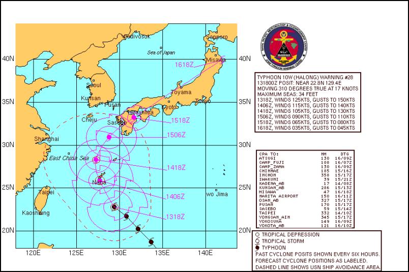
Click On Image For Full JTWC Graphic
According to the US Navy’s Joint Typhoon Warning center (and the NOAA weather supercomputer) typhoon Halong, a category four typhoon (one level below the top level) is headed directly for the Japanese mainland.
The typhoon is expected to landfall in three days and to run directly down the length of the Japanese mainland. It may cause widespread flooding in many parts of the country which have just experienced extensive flooding and damage as a result of a direct hit from typhoon Chataan just last week.
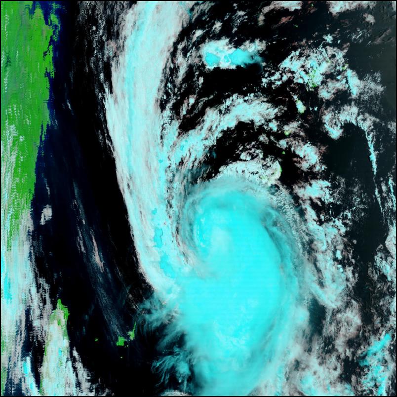
Latest NASA MODIS satellite images of typhoon Halong.

Typhoon Halong & Japan
Click On Image For Bigger Version
The latest JTWC satellite image of typhoon Halong.
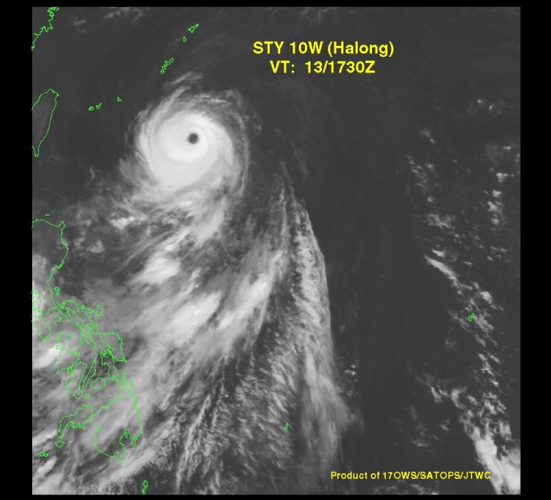
Typhoon Halong & Japan
Click On Image For Bigger Version
Links:
Joint Typhoon Warning
Center
http://www.npmoc.navy.mil/jtwc.html
University Of
Wisconsin Typhoon Halong (10W) Page
http://cimss.ssec.wisc.edu/tropic/real-time/westpac/storm/storm12.html#SPECIAL
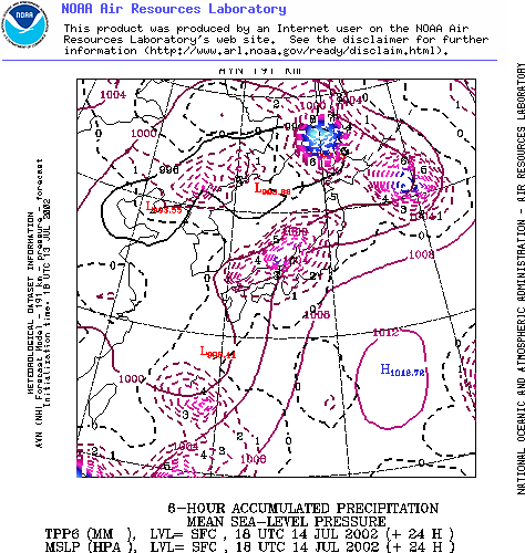
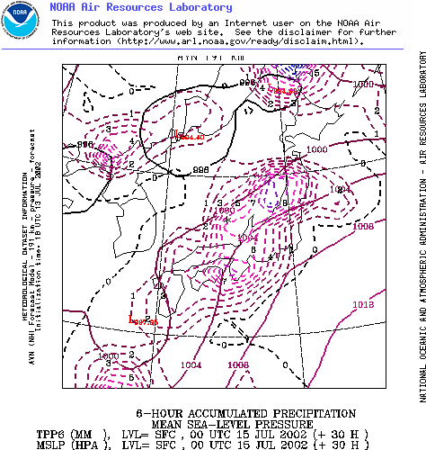
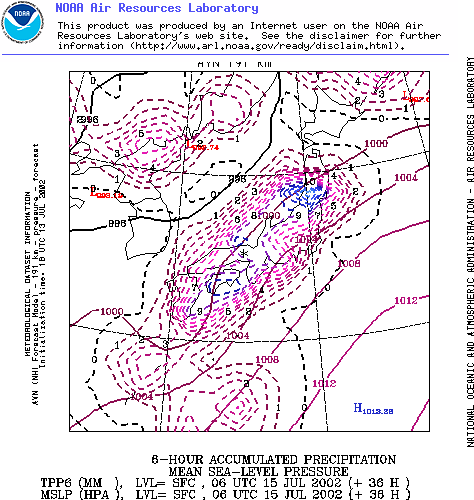
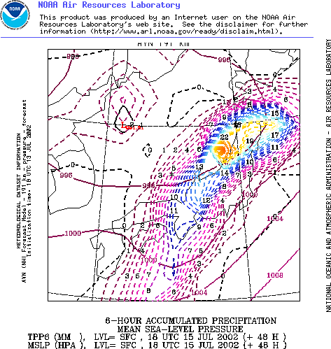
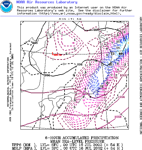
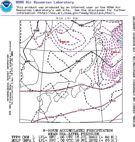
The following is the latest NOAA aviation model forecast of the path of Halong over Japan with precipitation (rain) shown in coloured lines.
July 14th
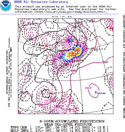
July 15th
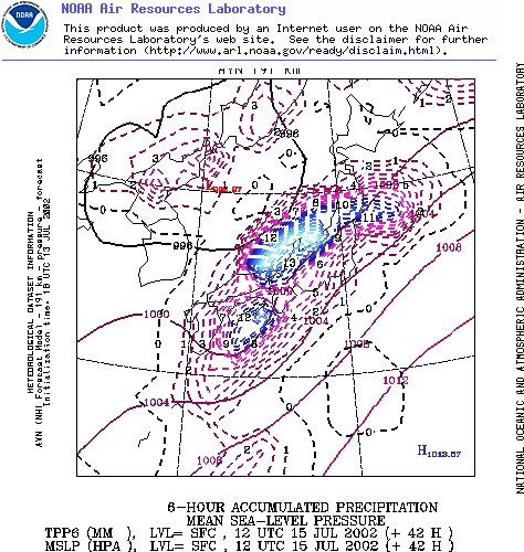
July 16th
 Richard S. Ehrlich: Cyber-Spying 'From Lhasa To London' & Tibet Flexing
 Gordon Campbell: On Aussie Election Aftershocks And Life Lessons
 Martin LeFevre - Meditations: Regarding Popes, Dopes And Hopes
 Binoy Kampmark: Fantasy And Exploitation | The US-Ukraine Minerals Deal
 Gordon Campbell: On The Aussie Election Finale
 Martin LeFevre - Meditations: The Enlightenment Is Dead; What Is True Enlightenment?
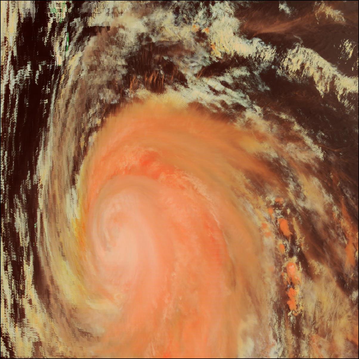