 Scoop has an Ethical Paywall


Morphum Environmental And Lynker Analytics Awarded Government Contract To Identify Wetlands Using New Technology
A new way to identify and map natural wetlands, using artificial intelligence, is being developed by two local companies as part of a contract agreement with the Ministry for the Environment.
“Being able to accurately and quickly identify natural wetlands using the latest suite of technological tools will not only save time and money for landowners and councils, but it will lift also the bar for the environmental protection of wetlands,” said Caleb Clarke, Director of Morphum Environmental.
The two companies involved are the environmental science and engineering specialist Morphum Environmental and data science specialist Lynker Analytics.
Additional protection for wetlands was introduced in the Government’s Essential Freshwater package which came into effect from early September.
The National Policy Statement for Freshwater Management 2020 requires “the loss of extent of natural inland wetlands is avoided, their values are protected, and their restoration is promoted” as well as a specific requirement that councils identify and map their natural inland wetlands to at least 500m².
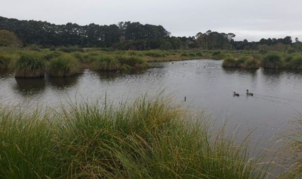
Wetlands provide numerous benefits including protecting and improving water quality, providing a habitat for wildlife, carbon sequestration, storing floodwater and maintaining surface water flow during dry periods.
Because wetland mapping is a difficult and time-consuming process it has concentrated on more significant wetlands. There is no uniform national understanding of where wetlands are, especially smaller wetlands on private land.
Under the contract, Morphum Environmental and Lynker Analytics will develop and pilot a methodology to map wetland extent to a minimum area of 500 m2 that can then be applied consistently at a regional or national scale.
The diverse nature of wetland ecosystems present multiple challenges to the design and development of a mapping solution.
The solution will use applied science together with engineering and data science.
Piloting the approach with landowners interested in taking part will be a key aspect of the project.
About the project
This project team includes personnel experienced in identifying, delineating and classifying wetlands in the field. Morphum’s environmental engineers also have experience in designing and constructing wetland systems which provides a unique understanding of the hydrological components of wetlands as well as, the occurrence and nature of wetlands induced by the built environment.
The methodology will consider a wide range of data inputs including aerial photography, satellite imagery, LiDAR and existing GIS data including; soil type and hydrology. “One option is to apply deep learning techniques to these large data sets to build a digital profile of wetland class and then to delineate or map the extents,” says Matt Lythe, Managing Director of Lynker Analytics. “Deep learning is a is a subset of machine learning that uses artificial neural networks to learn complex and intricate patterns in large data sets.”
Scheduled for completion in May 2021 the project aims to deliver a pragmatic, consistent and cost-effective means that regional councils could choose to use to implement the requirements to map and classify wetlands under the proposed NPS-FM.
 Trademe: Trash To Treasure - Kiwi Make The Most Of Unwanted Christmas Gifts
  Financial Markets Authority: FMA Seeks Clarity From High Court On Use Of Eligible Investor Certificates In Wholesale Investment Sector
 Scion: Scion’s Novel Internship Model Connects Talent With Industry
 Financial Markets Authority: Westpac Admits To Misleading Representations That Resulted In $6.35m In Overcharges
 Bill Bennett: Download Weekly - Review Of 2024
 Bill Bennett: One NZ scores worldwide first as Starlink direct-to-mobile launches


