 Scoop has an Ethical Paywall


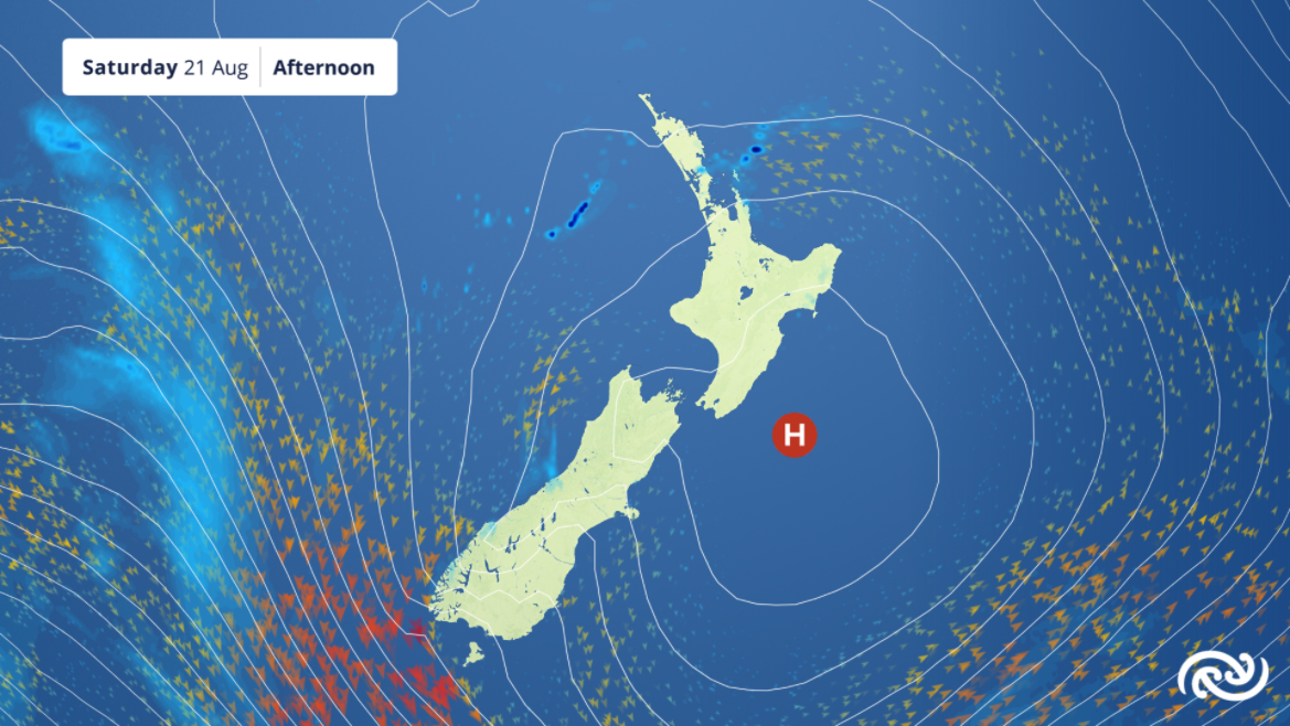
Sunny Saturday
MetService is forecasting a run of settled weather from Saturday after an active front tomorrow (Friday), apart from the western South Island, which returns to wet weather on Sunday.
A cold front that spreads from the South to the North Island tomorrow brings a close to the working week with rain and showers.
MetService meteorologist Mmathapelo Makgabutlane elaborates: “Elevated parts of the South Island are even likely to get snow to between 600 and 700 metres, and MetService has issued a number of Road Snow Warnings for the overnight period into Friday morning.”
Apart from brief lingering showers for the northern and northeastern reaches of the North Island at the start of the weekend, a high pressure system moves onto the country and brings dry, but nippy weather for the rest. “Cold starts will give way to sunny skies for most, which will no doubt be welcome news for those looking forward to their daily bubble walks,” Makgabutlane commented.
Conditions remain settled until the next front arrives on Sunday and stagnates over the top of the South Island. This front brings rain for the western parts of the island, marking the onset of what will be a wet week for the West Coast, while the majority of the country gets a run of dry weather, albeit windy for some, for much of next week.
This will also be evidenced by the daytime temperatures, where some of the eastern South Island will get their warmest highs of the month so far. “Christchurch and Ashburton are projected to reach 19°C on Monday. You’ll need to think back to the beginning of last month when temperatures last reached the high teens in the Canterbury region,” Makgabutlane said.
While the people of Aotearoa do their bit by staying home, the weather does not stop. “Whether you’re an essential worker heading to work, on your way to get a jab, or just taking a stroll around the neighbourhood, MetService will continue to provide weather details for all your needs.” Makgabutlane said.
 Gordon Campbell: On What’s Wrong With The Treaty Principles Bill
 NZ National Party: National Acknowledges The Passing Of Hon Nikki Kaye
 Mana Mokopuna: Children And Young People Share Vital Insights On Healing From Family Violence And Sexual Violence In New Report
 NZ Government: PM Marks One Year In Government
 Helen Clark Foundation: Helen Clark Foundation Calls For Political Action To Reduce The Prevalence Of Junk Food And Improve Health Outcomes
 Justice Committee: Further Decisions About Submissions Process For The Principles Of The Treaty Of Waitangi Bill
 Infrastructure New Zealand: Single Agency Needed To Coordinate Climate Adaptation And Recovery