 Scoop has an Ethical Paywall


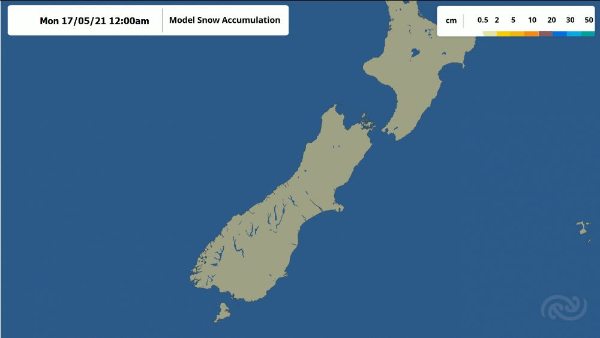
Snow In The South
The changeable weather continues as fronts march across the country, with MetService forecasting snow showers to low altitudes for southern parts of the South Island tomorrow (Tuesday) morning.
A low pressure system moving across the North Island today (Monday) sweeps across a band of rain, heavier and more persistent for southwestern parts with a risk of thunderstorms and strong wind gusts. A Heavy Rain Watch is in place for Horowhenua, Kapiti, Wellington, and the Tararua Range.
Turning our attention to the south, a cold front over Fiordland makes its way up the South Island this afternoon and evening, bringing rain to the West Coast, Otago, and Southland, then another one follows overnight going into Tuesday. A Heavy Rain Watch is in place for Fiordland.
The real kicker is the cold unstable air behind the second front, where wintery showers are expected to fall as snow to low levels: 200 metres for Southland, Clutha, and Fiordland; and 300 metres for Otago. A Heavy Snow Warning is in place for Fiordland and a Heavy Snow Watch is in place for Southland, Clutha, and Central Otago. The lowest snow is expected early in the morning, with the snow level set to rise throughout the day. There is also a risk of gusty thunderstorms and hail in the morning in the south and west.
Road Snow Warnings have been issued for many higher roads. Snow settling on roads can make driving hazardous. As usual, be sure to check out the NZTA website for potential impacts to travel. Meteorologist Dan Corrigan remarks, “We’re expecting this to be the lowest snow so far this year. With last week’s snowfall as well, it’s beginning to feel a bit like winter.”
While snowfall does bring about risk for livestock and transport, the new topping of snow will be welcomed by the ski fields in the Queenstown Lakes District in preparation for the snow season.
Furthermore, southwesterly winds may approach severe gale in exposed places for the lower South Island from later tomorrow morning into the evening. Strong Wind Watches are in place.
Meanwhile, the first cold front quickly crosses the North Island tomorrow morning, ushering in a showery day for most, but staying mostly fine in the east. However, a Strong Wind Warning has been issued for Hawke’s Bay and the Tararua District, where northwesterly winds may approach severe gale in exposed places, while Wellington and the rest of the Wairarapa are under a Strong Wind Watch. There is also a risk of morning thunderstorms with strong wind gusts in the west from Auckland down to Taranaki.
The cold airmass restricts daytime maximum temperatures to the low teens in the South Island – 10C and under south of Dunedin. North Island temperatures remain around average for mid-May.
The wild weather eases on Wednesday, with a few showers continuing in the west of both islands, and mostly clear skies in the east.
This easing trend
continues into Thursday, and remaining showers clear for the
North Island.
 Gordon Campbell: On What’s Wrong With The Treaty Principles Bill
 NZ National Party: National Acknowledges The Passing Of Hon Nikki Kaye
 Mana Mokopuna: Children And Young People Share Vital Insights On Healing From Family Violence And Sexual Violence In New Report
 NZ Government: PM Marks One Year In Government
 Helen Clark Foundation: Helen Clark Foundation Calls For Political Action To Reduce The Prevalence Of Junk Food And Improve Health Outcomes
 Justice Committee: Further Decisions About Submissions Process For The Principles Of The Treaty Of Waitangi Bill
 Infrastructure New Zealand: Single Agency Needed To Coordinate Climate Adaptation And Recovery