High Pressure Holding On For Now
A blocking ridge of high pressure lingers to the east of New Zealand through to the end of the weekend, with MetService predicting settled and warm weather to prevail across much of the country for the remaining days of summer.
A frontal system that brought heavy rain to the west of the South Island earlier this week has weakened and become slow-moving over central New Zealand. The front continues to decay as it drifts southwards tomorrow (Friday), bringing light rain to the West Coast of the South Island. The remainder of the country can expect a mix of fine weather, some cloud and a few showers during the next few days, with most of the shower activity expected to occur about inland places.
Generally warm temperatures are forecast for the remainder of summer, with many places expected to reach the mid to high twenties during the afternoons.
MetService Meteorologist Peter Little comments, “More warm, humid nights are likely over northern New Zealand through until early next week, which will continue to make sleeping uncomfortable for those without air-conditioning.”
The settled end to summer is also good news for those folk planning on attending the Wings over Wairarapa Air Festival near Masterton this weekend.
“Fine weather is forecast for the Wings over Wairarapa Air Festival, along with light winds and daytime temperatures in the high twenties,” adds Little.
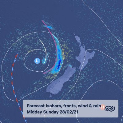
Early next week the blocking ridge looks to finally lose its grip, allowing a new frontal system over the Tasman Sea to spread rain into western parts of the country.
Little says, “It looks like it will be a damp start to autumn next week for western regions, while generally dry and warm weather continues in the east.”


 Gordon Campbell: On What’s Wrong With The Treaty Principles Bill
 NZ National Party: National Acknowledges The Passing Of Hon Nikki Kaye
 Mana Mokopuna: Children And Young People Share Vital Insights On Healing From Family Violence And Sexual Violence In New Report
 NZ Government: PM Marks One Year In Government
 Helen Clark Foundation: Helen Clark Foundation Calls For Political Action To Reduce The Prevalence Of Junk Food And Improve Health Outcomes
 Justice Committee: Further Decisions About Submissions Process For The Principles Of The Treaty Of Waitangi Bill
 Infrastructure New Zealand: Single Agency Needed To Coordinate Climate Adaptation And Recovery


