Slow Low Makes Snow
Slow Low Makes Snow
It has been a warm week for New Zealand with temperatures well above monthly averages. Benign but cloudy weather and generally light winds have kept frosts away and boosted temperatures. All of this changes next week as a cold snap brings snow and southerlies to the country.
The average temperature at Christchurch airport in the last week was 8.4C compared to a monthly average of 5.8C, and it hasn’t dropped below freezing there since the 18th. Other centres have also been above historical averages, with Wellington averaging 10.1C over the last week, 1.2 degrees above normal. Auckland’s July normal is 10.9C, but so far this month has averaged 11.8C.
Next week brings a cold snap that will make Kiwis reach for their extra blankets, but also their boards and skis as the mountains get a long-overdue top up of snow. Although this is not unusual for the time of year, motorists and high-country farmers should be prepared for the colder conditions.
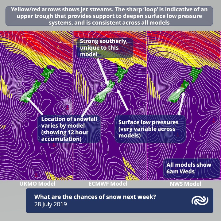
Unlike true southerly systems that barrel into New Zealand from the Southern Ocean, the cause of this cold snap will be more localised. A trough slowly rolls across the country over the next few days and will bring heavy rain to Westland, where a heavy rain watch is already in force. On Tuesday the upper atmosphere comes in to play as a sharp upper trough moves over.
“This is what the surface trough has been waiting for,” explains MetService meteorologist Tom Adams. “What starts as a fairly weak system suddenly gets amplified and localised low pressure systems deepen within it. If a good low forms east of the South Island that would be the perfect recipe for a dump of snow in Canterbury and Otago.”
“With these multi-centred systems a small change in the depth and location of those lows can make a big impact,” he continued, “so our forecasters carefully compare multiple models to gauge the certainty. At present we are expecting snow in Canterbury to 600 metres, but that could easily be lower once the models show more agreement. There is also a good chance of more snow towards the end of next week so make sure you keep an eye on the latest updates from MetService.”


 Gordon Campbell: On What’s Wrong With The Treaty Principles Bill
 Te Pāti Māori: Government’s First Year A ‘Catastrophe For Māori’
 Department Of Internal Affairs: Samoan Citizenship Bill Passes Into Law
 NZ National Party: National Acknowledges The Passing Of Hon Nikki Kaye
 Mana Mokopuna: Children And Young People Share Vital Insights On Healing From Family Violence And Sexual Violence In New Report
 NZ Government: PM Marks One Year In Government
 Helen Clark Foundation: Helen Clark Foundation Calls For Political Action To Reduce The Prevalence Of Junk Food And Improve Health Outcomes


