A settled week for most makes way for wetter week ahead
A settled week for most makes way for wetter week ahead
This past week has followed the trend for the month of May, which has proven to be well below average for many places around the country in terms of rainfall but with warmer and well above average daytime temperature.
“The temperature in Wellington hasn’t dropped below double digits since Monday morning, and is not expected to drop below 13C this coming week” explained MetService meteorologist Kyle Lee. “Today’s maximum temperatures across the country aren’t expected to be below 14-15C for the main centres, well above average for most of the South Island,” continues Lee.
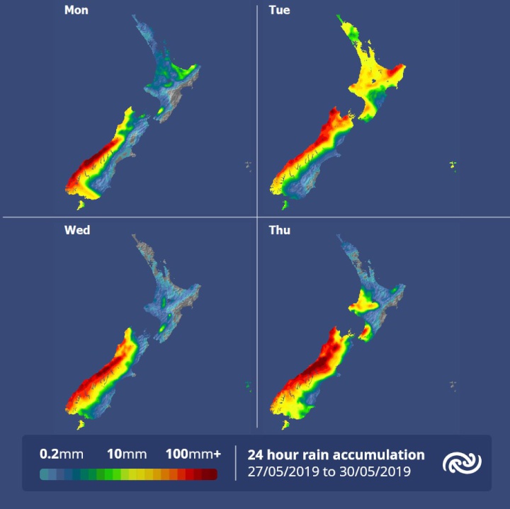
Not all the country is seeing settled weather though as MetService currently has Heavy Rain Watches and Warnings in force for Fiordland, the headwaters of Otago Lakes and Rivers, and Westland south of Otira, with thunderstorms also expected in these areas. This week we will see the return to a more Autumn like pattern with northwesterly winds and a few e significant fronts moving onto the country. These fronts will bring rain as well as strong winds to most places.
The west coast of the South Island will especially be affected as it will see a prolonged rain event from today. “This could be a significant rain event and rainfall accumulations are likely to exceed 500mm in some places over a four- or five-day period,” said Lee.
Towards the end of the week, as we approach the official start date of winter, we are in line to see more fitting weather as cold southwesterlies are set for New Zealand.


 Gordon Campbell: On The Hikoi Aftermath
 NZ Government: PM Marks One Year In Government
 Helen Clark Foundation: Helen Clark Foundation Calls For Political Action To Reduce The Prevalence Of Junk Food And Improve Health Outcomes
 Justice Committee: Further Decisions About Submissions Process For The Principles Of The Treaty Of Waitangi Bill
 Infrastructure New Zealand: Single Agency Needed To Coordinate Climate Adaptation And Recovery
 Free Speech Union: Fair Digital News Bargaining Bill Likely To Restrict Access To Information, Polling Shows Most Oppose
 Auckland Transport: Driver Safety Screens Now Rolling Out Across Auckland’s Bus Fleet


