Heavy Rain and Strong Winds on the Way
With severe weather confined to Fiordland today, heavy rain and strong winds may seem far away for the rest of New Zealand. However as we head into Wednesday severe weather will spread to other parts of the country as an active front moves across both Islands.
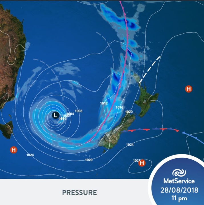
“A deep low pressure system that develops over the Tasman Sea on Tuesdaywill be the conductor of this week’s weather,“ April Clark MetService Meteorologist commented. “Though the low is forecast to remain west of New Zealand it will direct a number of active fronts towards our waters, with the first expected on Wednesday.”
Strong northeasterlies and heavy rain are set to accompany the Wednesdayfront, with the worst hit areas expected to be the upper North Island and northwest corner of the South Island. The Bay of Plenty region in particular is signalled to receive significant rainfall on Wednesday and possibly into Thursday. Severe Weather Warnings are likely to be issued Tuesday morning in anticipation of the front, and these will be found at http://bit.ly/AllWarnings
“Many other regions see deteriorating weather on Wednesday, due to northeasterlies ahead of the front that will drag in warmer, moister rain-laden air from the north. This means that few New Zealanders escape at least a brief dose of rain.” Clark said
The increase in moisture will also bring cloudier skies to the country compared to the weekend just gone.
The weather for the later part of the week remains unsettled with the low pressure in the Tasman expected to continue sending fronts our way. The changeable weather this week means it is an important time to keep up to date with latest forecasts.


 Gordon Campbell: On What’s Wrong With The Treaty Principles Bill
 Ministry For Culture And Heritage: Reverberations Of Erebus Disaster Still Felt 45 Years Later
 Watercare Services: No Cause For Concern After Slightly Elevated Levels Of Arsenic Detected In Treated Waikato River Water
 Te Pāti Māori: Government’s First Year A ‘Catastrophe For Māori’
 Department Of Internal Affairs: Samoan Citizenship Bill Passes Into Law
 NZ National Party: National Acknowledges The Passing Of Hon Nikki Kaye
 Mana Mokopuna: Children And Young People Share Vital Insights On Healing From Family Violence And Sexual Violence In New Report


