Changing Conditions on the Way
“A ridge of high pressure is bringing fine and settled conditions to much of the country today”, said MetService meteorologist Mark Bowe. However, there is patchy drizzle in the west of the South Island and just a few light showers over Northland. “Auckland can expect another fine day, with a high of 16°C, and similar conditions down in Wellington with a high of 13°C”, Bowe adds. Just a few harmless clouds about in Christchurch with a high of 14°C to finish off the weekend. “Overall, it’s been a nice weekend for us across much of the country”, Bowe said.
However, the nice weather is due to change during Monday. “A frontal system over the Tasman Sea is making its way towards the lower South Island”, Bowe mentioned. Northerly winds are forecast to strengthen ahead of this feature over the lower South Island today and MetService have issued a Storm Warning for the Puysegur sea area. This is the beginning of a deteriorating trend as the moist northeast flow gradually spreads over the country ahead of this frontal feature on Monday.
This feature will bring a period of heavy rain into western areas of the lower South Island. MetService have issued a Heavy Rain Watch for the possibility of rainfall accumulations reaching warning criteria in Fiordland and the ranges of Westland south of Fox Glacier during Monday. The rain band should reach the north of the country on Monday evening, with rain and strong northerly winds expected for the areas around and north of Auckland, then turning into unsettled westerlies into Tuesday. “We are keeping a close eye on the development of this system as it is passes over the upper North Island”, Bowe said. He went on to explain, “rain with brief heavy falls are forecast with the front, and there is also the possibility of severe gales over the upper North Island on Tuesday as the system moves across.”

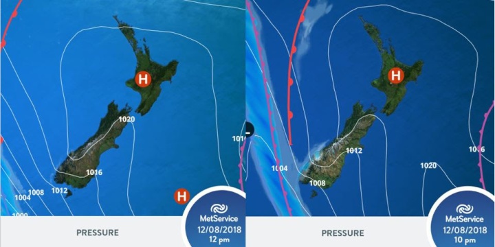
The images above show the
frontal feature approaching from the west this
evening.


 Gordon Campbell: On What’s Wrong With The Treaty Principles Bill
 Ministry For Culture And Heritage: Reverberations Of Erebus Disaster Still Felt 45 Years Later
 Watercare Services: No Cause For Concern After Slightly Elevated Levels Of Arsenic Detected In Treated Waikato River Water
 Te Pāti Māori: Government’s First Year A ‘Catastrophe For Māori’
 Department Of Internal Affairs: Samoan Citizenship Bill Passes Into Law
 NZ National Party: National Acknowledges The Passing Of Hon Nikki Kaye
 Mana Mokopuna: Children And Young People Share Vital Insights On Healing From Family Violence And Sexual Violence In New Report


