Calm Start with a Wet & Windy End this Weekend
Calm Start with a Wet & Windy End this Weekend - 12 July 2018
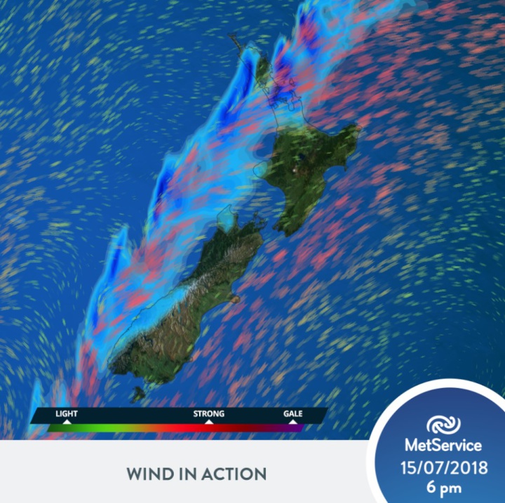
MetService meteorologists are forecasting a settled, calm end to the week, with a cool start to Fridaymorning set to contrast with this weekend’s weather. A significant weather system moves over the country in the latter half of the weekend, bringing strong northeasterly winds and heavy rain, with possible downpours to northern and western regions of the country.
A high-pressure system gives a dry start to the weekend for much of New Zealand, with a few showers for northern and western coastal areas. This continues into Saturday, with the approaching trough increasing the winds over New Zealand.
“The northeasterly winds set up over the country during Saturday,” says MetService meteorologist Tui McInnes, “so temperatures will warm up across the country. This will be most noticeable in the mornings, especially compared to the cool start to Friday.”
A significant band of rain then approaches the country, setting in late on Saturday for the Far North and bringing gusty northeasterly winds to that region.
“The highest impact from the weather feature is expected on Sunday through into Monday,” explains McInnes. ”The upper North Island, in particular from Northland through Auckland and Bay of Plenty to the ranges of Gisborne, and the West Coast of the South Islands are set to face the brunt of the weather, while eastern areas of the South Island end the weekend on a dry but cloudy note.”
This means periods of rain, possibly heavy at times with downpours possible, and strong, gusty northeasterly winds for those exposed to the northeasterly flow, with the Nelson region also seeing some large rain accumulations. This weekend Auckland and northern areas will have king tides coinciding with the bad weather so there is a concern of associated coastal inundation. Please take advice from your local council in this matter.
“As the front continues moving southeast on Monday, the wet weather will drift across much of the country, clearing up behind it,” McInnes says, adding “this has the potential to be a significant weather event, so it pays to stay up to date with the latest severe weather information and keep safe.”


 Gordon Campbell: On What’s Wrong With The Treaty Principles Bill
 Ministry For Culture And Heritage: Reverberations Of Erebus Disaster Still Felt 45 Years Later
 Watercare Services: No Cause For Concern After Slightly Elevated Levels Of Arsenic Detected In Treated Waikato River Water
 Te Pāti Māori: Government’s First Year A ‘Catastrophe For Māori’
 Department Of Internal Affairs: Samoan Citizenship Bill Passes Into Law
 NZ National Party: National Acknowledges The Passing Of Hon Nikki Kaye
 Mana Mokopuna: Children And Young People Share Vital Insights On Healing From Family Violence And Sexual Violence In New Report


