Heavy rain in the north, bitter cold in the south
MetService News Release
Sunday 3 June
2018
Heavy rain in the north, bitter cold in the south
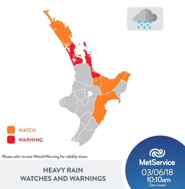
After heavy rain lashed Northland yesterday, with some weather stations recording over half of their average monthly rainfall in little over a day, Northland is experiencing some temporary relief from the wet weather. The rain band has now moved further south, with Auckland and Coromandel Peninsula now experiencing the worst of the weather, and it is expected to gradually move across Bay of Plenty this afternoon.
“Aucklanders can expect 50 – 70 mm of rainfall between the hours of 10 am and 6pm on Sunday, with the potential of localised downpours of 20 – 25 mm/hr or more and thunderstorms,” said MetService Meteorologist Claire Flynn. “This amount of rainfall could cause slips and surface flooding, as well as making driving hazardous, so people need to be aware of the risk and drive to the conditions.”
In addition to the Warning for Auckland, Coromandel Peninsula is under Warning for heavy rain until 9pm tonight, and Bay of Plenty west of Te Puke is under Warning until 6am Mondaymorning. The remainder of Bay of Plenty and also Gisborne north of Tokomaru Bay are under a Watch. The rain band will then move over Hawkes Bay tomorrow, also under a Watch.
“The rain
band is heading southwards, and Northlanders are
experiencing a lull in the weather. However, on Monday we
are expecting another rain band with possible thunderstorms
to move over Northland and Auckland, with a Severe Weather
Watch in force for further heavy rain for Northland between
3am and 3pm Monday,” cautioned Flynn.
The remainder of the North Island, as well as the top of the South Island and also Canterbury and North Otago can expect occasional rain through the remainder of Queen’s Birthday Weekend, though the heaviest falls are expected to remain in the north.
Further south, for the likes of Central Otago and inland Southland, the hard frosts that people have been experiencing are expected to continue for another day or two yet.
“There is a stark contrast in the weather from the
north to the south of the country this weekend, with Severe
Weather Watches and Warnings out for the northern half of
the North Island, while southern areas have been
experiencing very settled, but bitterly cold weather,”
explained Flynn. “We have been seeing overnight lows well
into the negatives down south, with Mt. Cook Airport
reporting -10.4C on Sunday morning. Other areas haven’t
managed to break 0°C during the daytime – the high
temperature in Alexandra on Saturday was -0.6C.”
The
settled weather and hard frosts are expected to continue for
another day or two yet, before strong southerlies begin to
move up the country on Tuesday with the next weather system.
While the southerlies will put an end to the extreme low
temperatures we have seen over the past few days, it
certainly will not be warm – the strong winds will bring
heavy rain to eastern areas, with snow lowering to about 400
metres, with the potential to significantly disrupt
travel.

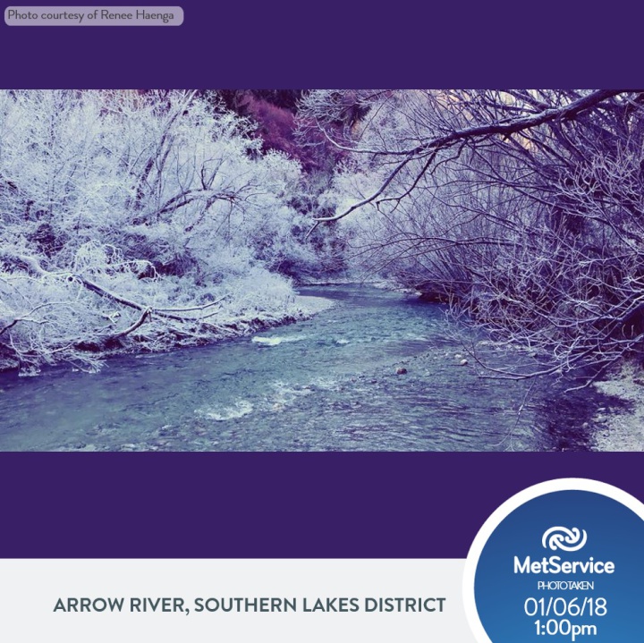
Hoar frost lasted all day in parts of Otago for the past several days - this photo was taken at1pm in the afternoon by Renee Haenga in Arrowtown on Friday.
Official Severe Weather Watches and
Warnings are reviewed and re-issued by MetService at least
every twelve hours, and more often if necessary. To get the
most up to date information on severe weather around the
country, or any other forecasts, see metservice.com or on mobile devices at
m.metservice.com. You can also follow
our updates on MetService TV, at MetService New Zealand on Facebook, @metservice and @MetServiceWARN on Twitter and at blog.metservice.com
MetService issues Warnings, Watches and
Outlooks for severe weather over New Zealand.
Warnings are about taking
action when severe weather is imminent or is occurring. They
are issued only when required.
Recommendation: ACT
Watches are about being alert when
severe weather is possible, but not sufficiently imminent or
certain for a Warning to be issued. They are issued only
when required.
Recommendation: BE READY
Outlooks are about looking ahead,
providing advance information on possible future Watches
and/or Warnings. They are issued routinely once or twice a
day.
Recommendation: PLAN


 Gordon Campbell: On What’s Wrong With The Treaty Principles Bill
 Ministry For Culture And Heritage: Reverberations Of Erebus Disaster Still Felt 45 Years Later
 Watercare Services: No Cause For Concern After Slightly Elevated Levels Of Arsenic Detected In Treated Waikato River Water
 Te Pāti Māori: Government’s First Year A ‘Catastrophe For Māori’
 Department Of Internal Affairs: Samoan Citizenship Bill Passes Into Law
 NZ National Party: National Acknowledges The Passing Of Hon Nikki Kaye
 Mana Mokopuna: Children And Young People Share Vital Insights On Healing From Family Violence And Sexual Violence In New Report


