 Scoop has an Ethical Paywall


Storm Warning Remains But Worst Waether Has Passed
The Worst Has Passed
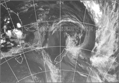
The deep low off the Wairarapa Coast that brought stormy conditions over the lower North Island is forecast to move away to the southeast from late morning,with the rain and severe southerly gales easing. However, another 20 to 30mm of rain is still possible in parts of Wellington, Wairarapa, Wanganui, Taihape and southern Taranaki until midday today.
Also severe gale southerlies are still likely in exposed parts of Wellington, Wanganui and coastal Wairarapa until late morning, with gusts of 140 km/h possible, however the winds should rapidly ease from midday.
People in these areas are advised to watch for further potential flooding and rapidly rising rivers. Also, the winds could cause further damage to trees,powerlines and lift roof iron, as well as making driving conditions hazardous,especially for large trucks or vehicles towing caravans.
More Detailed Information For Emergency Managers And Technical Users Follows:
HEAVY RAIN WARNING.
AREA/S AFFECTED: WAIRARAPA, EASTERN HILLS OF WELLINGTON, THE WANGANUI HILL COUNTRY, MT TARANAKI, TAIHAPE AND HAWKES BAY SOUTH OF NAPIER FORECAST:
WAIRARAPA, EASTERN HILLS OF WELLINGTON, THE WANGANUI HILL COUNTRY, MT TARANAKI, TAIHAPE AND HAWKES BAY SOUTH OF NAPIER In the 4 hours from 8am to midday Monday, another 20 to 30mm of rain is possible in some places, before clearing this afternoon.
STRONG WIND WARNING.
AREA/S AFFECTED: EXPOSED PARTS OF WELLINGTON, WANGANUI AND COASTAL WAIRARAPA FORECAST:
WELLINGTON, WANGANUI AND COASTAL WAIRARAPA Severe southerly gales are still likely, especially about exposed hill tops,with gusts of 140 km/h possible until 10am Monday. The winds should rapidly ease from midday.
WARNINGS NO LONGER IN FORCE
STRONG WIND WARNINGS HAVE BEEN LIFTED FOR: FOR SOUTHERN TARANAKI The southerly gales have eased. NO FURTHER WARNINGS WILL BE ISSUED FOR THIS EVENT FOR THE ABOVE AREAS.
NEXT SEVERE WEATHER WARNING WILL BE ISSUED AT OR BEFORE 2:00pm Monday 16-Feb-2004
Forecast
prepared by: Andy Downs - A service provided through a
contract with the Crown
 Gordon Campbell: On The Left’s Electability Crisis, And The Abundance Ecotopia
 NZ Police: New Zealand Police team up with Z Energy, NZTA and ACC to remind Kiwis to drive safe this Easter
 NZCAST: NZCAST Leads Ongoing Cross-Agency Collaboration To Break Down Barriers For Survivors Of State Abuse
 Regional and Unitary Councils Aotearoa: Regional And Unitary Councils Back A Practical FWFP System
 NZ Government: Stay Safe On Our Roads This Easter
 YWCA: Global Push Back Against Gender Equality A Growing Crisis In Aotearoa
 Te Pāti Māori: Ngarewa-Packer - Fast-Tracking Seabed Mining Ignores Māori Opposition And Environmental Precedent