Steady Progress in Quake Monitoring Since Edgecumbe Quake
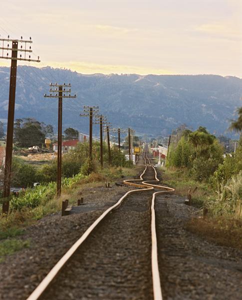
Click to enlarge
Railway track at Edgecumbe buckled by the magnitude 6.1 earthquake of 1987. Photo - GNS Science.
Tomorrow (Friday) is the 20th anniversary of the magnitude 6.1 Edgecumbe earthquake. In the two decades since 1987,
earthquake monitoring in New Zealand has made big advances. See attached backgrounder for more information.
--
NEWS BACKGROUNDER
2 MARCH 2007
Steady Progress in Quake Monitoring Since Edgecumbe Quake
New Zealand’s most damaging recent earthquake – a magnitude 6.1 jolt that struck eastern Bay of Plenty on the afternoon
of March 2, 1987 – occurred 20 years ago today.
Known as the Edgecumbe earthquake, it caused heavy damage in the towns of Edgecumbe, Te Teko, Kawerau, Thornton and
Matata. In Edgecumbe the ground-shaking cut deep gashes in roads and footpaths, damaged river embankments, tipped a
diesel locomotive off its tracks, and ripped power transformers, weighing up to 20 tonnes each, from their mountings.
In the Rangitaiki Plains, west of Whakatane, the quake tore up the ground to create a spectacular 7km-long fault rupture
that was, in places, 4m deep and 2m wide. The rupture extended down several kilometres into the earth.
About 200sq km of the Rangitaiki Plains subsided by up to 2m as a result of the quake. Property damage totalled $400
million ($690 million in today’s terms). Remarkably no-one was killed, but a handful of people suffered injuries.
In Edgecumbe the quake put most essential services out of action and it was a challenge for many to go without running
water, electricity, gas, and sewerage until they were restored.
Centred near Matata, the quake was felt over most of the North Island. It was preceded by a number of foreshocks in
Matata and Thornton, and followed by hundreds of aftershocks over several weeks.
One of the largest foreshocks, a magnitude 4.9 jolt, occurred seven minutes before the main shock and was largely
responsible for the evacuation of many buildings. Lives were probably saved as a consequence.
In 1987 it took over an hour for scientists to work out the location, magnitude and depth of the Edgecumbe earthquake.
They relied on a sparse network of aging instruments.
New Zealand’s earthquake and volcano monitoring capability has developed substantially in the last 20 years. Today
seismic data from around New Zealand is transmitted by radio and satellite and arrives within seconds at GeoNet data
centres in Lower Hutt and Wairakei. This enables scientists to identify the location, magnitude and depth of an
earthquake within minutes.
The GeoNet project, funded by the Earthquake Commission and operated by GNS Science, has seen major advances in the way
geological hazards are monitored in New Zealand. Not only are there more monitoring instruments, many of them solar
powered, but they are far more sophisticated and robust than those in use in the 1980s.
A significant advantage of the upgraded network is that it provides higher quality data in real-time.
The rapid availability of information on earthquakes through the GeoNet website gives responding agencies, such as civil
defence operators, the ability to prioritise in getting assistance to affected communities.
GeoNet Project Director, Ken Gledhill, said historical evidence showed that the risk to New Zealanders from geological
hazards is higher than the last 60 years would indicate.
“ New Zealand’s earthquake activity is comparable with California and Japan. But because there have been relatively few
large earthquakes in recent decades, many New Zealanders won’t have experienced a damaging earthquake,” Dr Gledhill
said.
On average, New Zealand can expect a magnitude 6 quake once a year, a magnitude 7 quake once a decade, and a magnitude 8
quake once every century.
The GeoNet network of instruments records about 16,000 quakes in and around New Zealand each year. Most are small, but
between 1 and 2 percent are big enough to be felt by people.
“ A major shallow earthquake, especially if located under or near a population centre, would affect the whole New
Zealand economy and even people distant from the quake would be affected,” Dr Gledhill said.
ENDS
Note:
GNS Science is a government-owned research and consultancy company focused on securing economic and social benefits from
natural processes occurring in the Earth’s crust. As well as improving the understanding of hazards such as earthquakes,
volcanoes, landslides, and tsunamis, GNS Science helps in the development of geothermal energy, oil and gas exploration,
mineral exploration, and groundwater supply to New Zealand towns and cities.